I had a wonderful little bike ride today, 48km distance with 1,720m of elevation gain (30 miles of distance with 5,600 feet of elevation gain). (The report of the ride at Strava reports longer distance and less elevation gain, but I trust Google's elevation data for Kyoto more than I truest my phone's GPS/GLONASS unit's elevation.)
Things didn't start well.
I went downstairs to my bike to find the rear tire quite flat, likely a slow leak from the spoke problem I had on the ride last week. I'd ridden 70km after it was fixed so I thought it was fine, but apparently not.
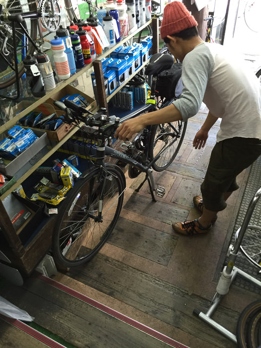
I could have changed the tube myself, but I worried that the problem originated in the wheel and so a new tube would quickly go flat as well, so I pushed the bike to my cycle shop and had them check it out.

iPhone 6 Plus + iPhone 6 Plus back camera 4.15mm f/2.2 at an effective 29mm — 1/15 sec, f/2.2, ISO 50 — map & image data — nearby photos
Fixing a Flat
A short wait and $15 later I had a new tube and a diagnosis that my wheel was fine. At noon I set off for the mountains.
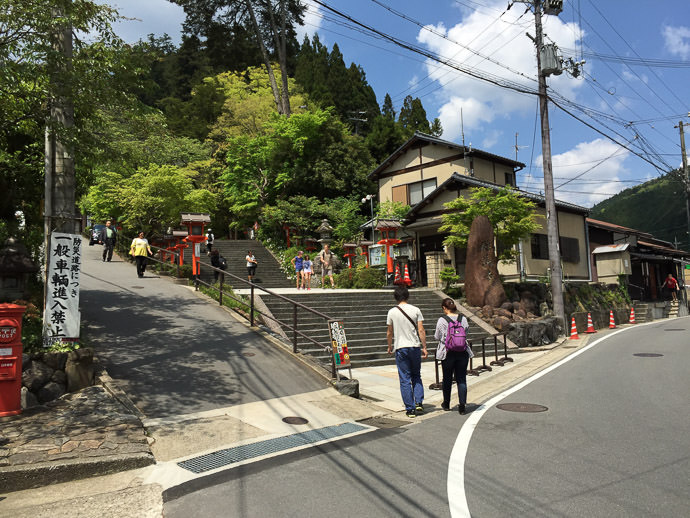
40 minutes and 14km later I arrived at Kurama Temple (鞍馬寺), and took a short break to buy a bottle of sports drink...

iPhone 6 Plus + iPhone 6 Plus back camera 4.15mm f/2.2 at an effective 29mm — 1/2200 sec, f/2.2, ISO 32 — map & image data — nearby photos
Entrance to the Kurama Shrine
marks the “real” part of the climb
This is where we had paused last week for cyclist photo ops.
Anyway, I quickly took off for Hanase Pass (花背峠). I would be my third attempt, the first having been 2½ months ago on my first real ride, and the second a week ago.
I'd climbed 200m in the 14km it took to get here, but now would almost quadruple that in less than half the distance... from here it's 6.2km of unrelenting slope.
This time I had one single secondary goal: make it to the top without pausing. (My primary goal, as always, is make it to the top without giving up).
So, I let myself fall into the easiest gear right away, and I just stayed there for the 38 minutes it took to the top. This time was 9:04 faster than the first, with its slushy roads and heavy camera. It was 4:22 faster than last week, which lacked the snow but not the camera.
Oddly, my heart rate never got above 138 bpm. Mostly my body could handle the climb just fine... the bigger problem is that I'm really weak-willed when it comes to physical exertion for its own sake. That's why my primary goal is always “don't give up”.
Anyway, I was pleased to arrive at the top without having stopped for anything, and like I said, my body can handle the slow pace, so I just kept on going down the other side. This was my first time to go down without the road being a sheet of ice, and it was exceedingly pleasant.
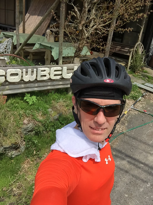
Five minutes of lovely downhill sweeping curves later, I was at “Cowbell”, a restaurant in the middle of nowhere:

iPhone 6 Plus + iPhone 6 Plus front camera 2.65mm f/2.2 at an effective 31mm — 1/1200 sec, f/2.2, ISO 32 — map & image data — nearby photos
Selfie at Cowbell
喫茶カウベル
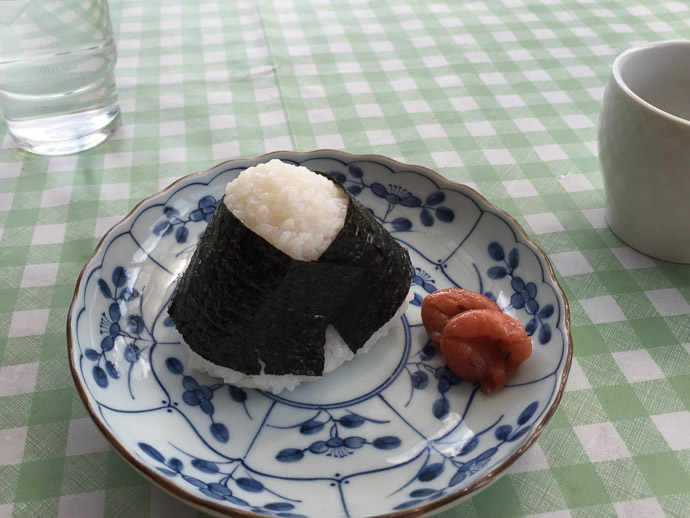
I ordered a cup of coffee and sat outside. I hadn't had anything to eat yet today, and I wasn't hungry, but I thought I should have some energy for the return climb. I didn't want either of the two food items they had on the menu (toast and curry rice), so I asked whether they'd make an onigiri (rice ball) for me, and they kindly did:

iPhone 6 Plus + iPhone 6 Plus back camera 4.15mm f/2.2 at an effective 29mm — 1/500 sec, f/2.2, ISO 32 — map & image data — nearby photos
Rice Ball
with umeboshi
I didn't want cramps on the way back, so sat and read a book for 50 minutes, then headed back.
It was my first time to ride up the back side of the mountain, and it ended up giving me the best feeling of accomplishment. I was in a middle gear just flying up, waiting for the difficult/steep sections that would require dropping down to the easiest gear, at which point I'd settle into a “just get it done” pace.
And suddenly I was at the top. I was shocked.
I knew this section was nowhere near as tough as the first climb (it turns out that it's just 170m of elevation gain over the course of 2.7km), but the hard parts never came, and it took just 13:10 (flying downhill on the way in had taken five minutes). Felt great!
Then from the pass back down to Kyoto, standing on the pedals, flying down and around corners at an average speed of 36kph, waving “hi” to cyclists riding up. Felt great.
Tomorrow should be a much longer ride... (UPDATE: it was)
I don’t mean to diminish your ride or accomplishment, just trying to understand the limits technology.
I am not an expert but I have been using Strava with my iPhone and it seems pretty accurate. Looking at your ride profile, the elevation gain seems slightly optimistic. Google Earth elevation numbers match the Strava profile close enough. Here is where I will get in trouble, simple math of start point to pass 150-2550=2400′ then Cowbell back to the pass 1950-2550=600′ for a total of 3000′. The small ups and downs in the ride will add some evalation but Strava 5000′ or the Google 5600′?
You are mastering mountain riding. Not giving in and finding ‘The Pace’ are the changes from flat land riding.
Bicycles and Japanese scenery, what more could I ask for.
Thanks
I’ve been wondering that myself. I live at an elevation of about 80m, and there’s one particularly large (50m) hill before starting the main ascent to 780m. Then down 200m and back up, then down and back up the 50m hill again. That seems to be 1000m of obvious stuff, plus the random little ups and downs. Maybe it’s a “coastline” issue… the length of a coastline can be measured as long as you like… want a longer distance, just get more granular and go around more bumps, down to the grain-of-sand bumps if you really want some distance. Or maybe they’re just trying to stoke the ego of their users. 🙂 —Jeffrey
Update: Well, you got me looking into it, and I figured it out. It turns out this ride actually had about 990m of vertical gain. See “The Voodoo of Elevation Gain and Strava (and How I Get Around It)” —Jeffrey
Congratulations! In one place I used to live, my home was at the top of a long, steep hill. Every spring I’d get my bike out to ride to work (mostly downhill) and back home (mostly uphill). I never had to walk it, but I’d be in first gear and pushing hard up the hill at first. Every day, every week would be a bit easier and I always challenged myself to be able to get up the hill in top gear by the end of the season!
Mike.