
Nikon D700 + Nikkor 70-200mm f/2.8 @ 135mm — 1/1250 sec, f/2.8, ISO 200 — map & image data — nearby photos
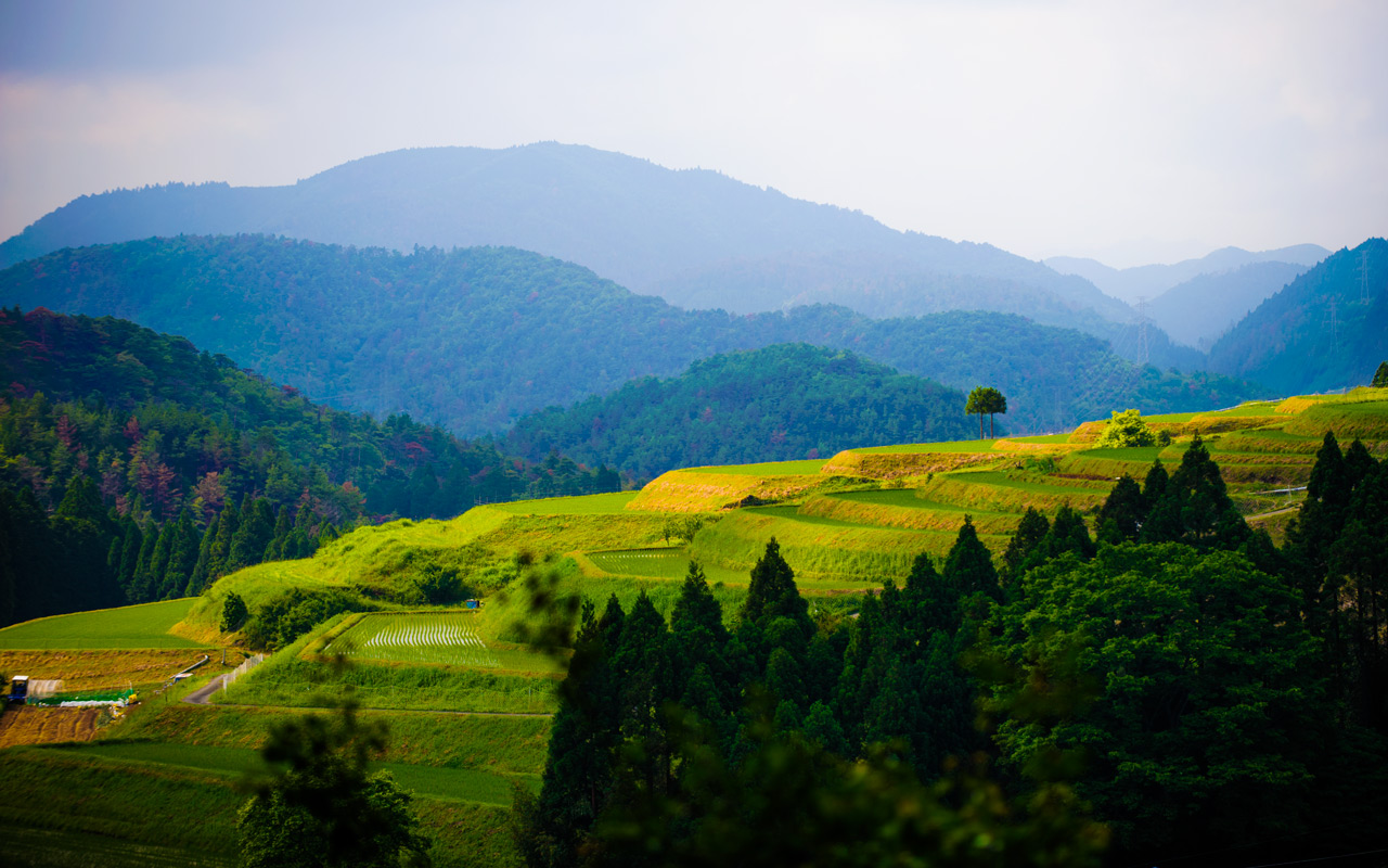
Layer Upon Layer
mountains of northwest Kyoto, Japan
This is sort of a followup to January's “Informal GPS Logger Test: iPhone 4s GPS is Shockingly Good” post about GPS and GLONASS loggers. We took a drive today in the mountains, and I took the opportunity for another informal test of location-logging technologies

Twisty
Garmin eTrex 20 GPS + GLONASS dedicated logger.
Dual® XGPS150 GPS-only bluetooth logger, recorded on an iPad with the Guru Maps app.
Apple iPhone 4s (GPS + GLONASS) recorded via the GeoTagr app, which for some reason the company sent me for free out of the blue the other day (probably hoping for a mention just like this), so I thought I'd give it a try. It worked nicely, and the DropBox tracklog export was convenient.
Google Latitude on my iPhone, via Google's Latitude app. The app has the same data available to it as the GeoTagr app (which is keeping the satellite antennas active), but Latitude works quite differently and ignores/loses almost all location information.
The general results were that the Garmin and Dual dedicated units were good, the iPhone dedicated app was okay, and Google Latitude was pathetic.
I recently added native Google Latitude support to my geoencoding-support plugin for Adobe Lightroom, so have been trying it in various conditions lately. Frankly, it's horrible... really really bad as a logger, and even worse than that when you might be out of cell-phone range... but I suppose it's better than nothing if it's all you've got.
During the drive, the Garmin unit recorded 18,338 data points (one per second).
The Dual® unit with the iPad app recorded 7,568 points, about one every 2½ seconds.
The GeoTagr app recorded 2,494 points, about one every 7⅓ seconds.
Google Latitude recorded 39 points, about one every eight minutes.

Lopped Off
but what's several kilometers among friends?
Google Latitude apparently doesn't use the GPS+GLONASS signal even when it's already there. It apparently doesn't try to keep too many data points in the first place, and just throws them away if it can't immediately contact Google servers. (Amid these complaints I should point out that I fully realize and appreciate that it's a cost-free service I'm also free not to use.)
Google Latitude is not really designed for this, and it shows, so it's best left as an emergency backup. Even in the city with excellent GPS and cell reception, it was pretty bad...

Zorro
The blip in the green iPhone track above is from when we were stopped at a traffic light. The iPhone seemed to really prefer moving, and tended to wander all over when actually stationary...

Convenience-Store Stop
We stopped for a longer time for a late lunch at the wonderful mountain cafe “Yama no Ie Hasegawa” (山の家はせがわ), presented here a year and a half ago. While we relaxed, the loggers were apparently running all over the place...

Lunch

Convincing Drift
The green iPhone track seems to pretty well match a set of roads, but the red (Dual) and orange (Garmin) tracks are correct.

Going and Coming
The green iPhone blips are likely pauses due to traffic
The real pleasure of the trip (from a mapping/location standpoint) was using the offline maps on my iPad with real-time tracking via the Dual® bluetooth unit that I was alerted to in a comment left on an earlier post. It was a pleasure to interact instantly on the huge iPad screen, even deep in the mountains far away from any Internet connectivity. (I just wish that Dual® had a name that wasn't a common English word, so that I could refer to it without having to add the “®” to make it clear I'm referring to a name. :-))
Interesting data (again). Latitude isn’t meant as a location data-logger. It’s a service to let friends know if they are in the same general area without constantly using the battery-draining GPS. Google even offers an open source tracking app on Android called My Tracks for actual GPS position logging.
–Bill
Indeed, that’s why I noted that Google Latitude wasn’t designed for how I was using it, but if the GPS receiver is already on, it’d be nice if it used the data (or had an option to use the data). But I don’t even know whether iOS allows an app to know whether the GPS receiver is on, so it may be a non-starter even if it’s a feature they wanted to add. —Jeffrey