NOTE: Images with an  icon next to them have been artificially shrunk to better fit your screen; click the icon to restore them, in place, to their regular size.
As I mentioned yesterday, we're not affected here in Kyoto by the big quakes yesterday, but of course it's big news. There are lots of amazing photos out there... I've found the location for a few so that you can see the “before” images on Google Maps...
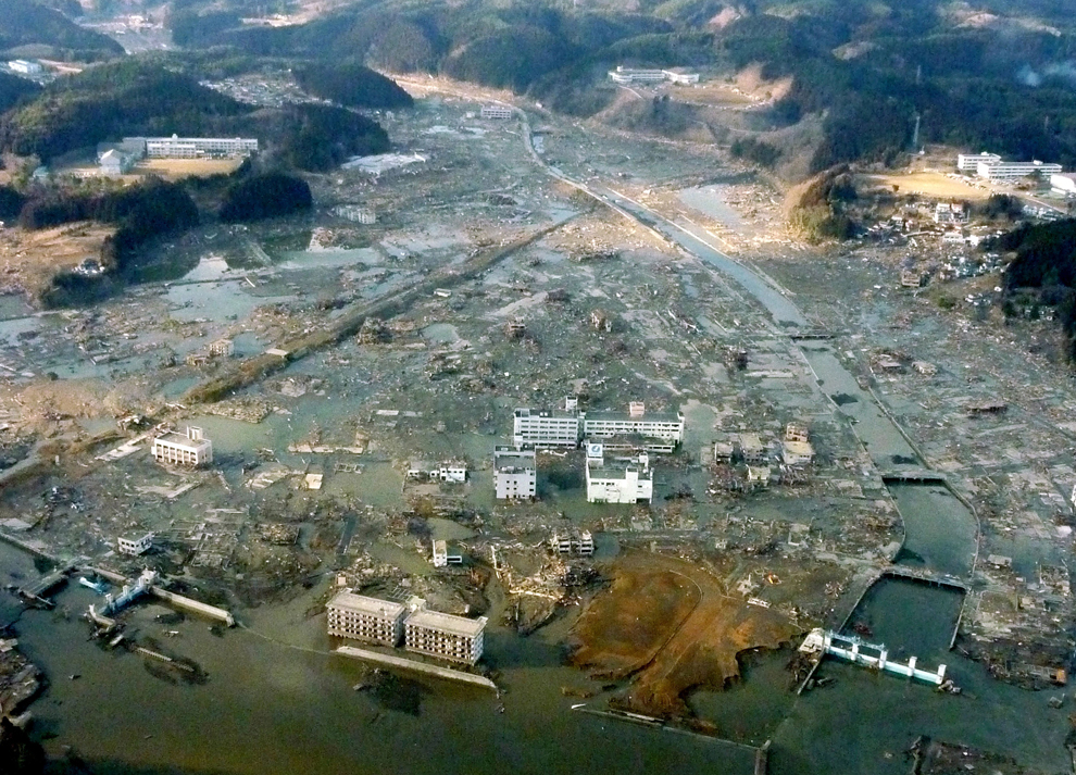
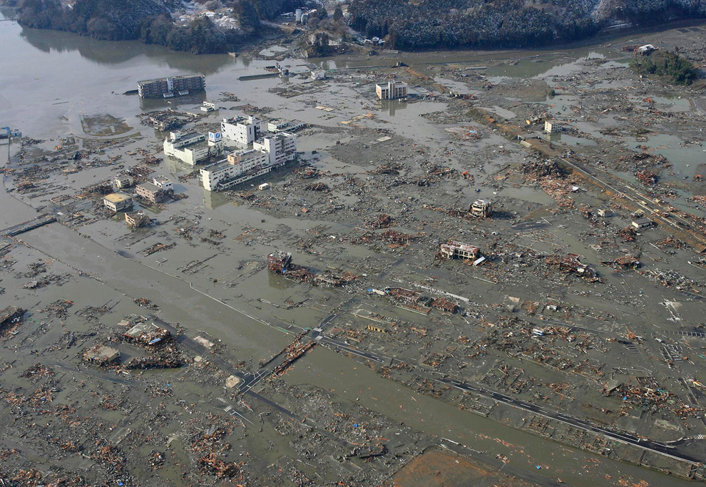 Photos at The Big Picture | Google Street View: biggest white building in the center of the top photo, upper-left of the second photo, so you can look around, to see what the town looked like when it still existed. |
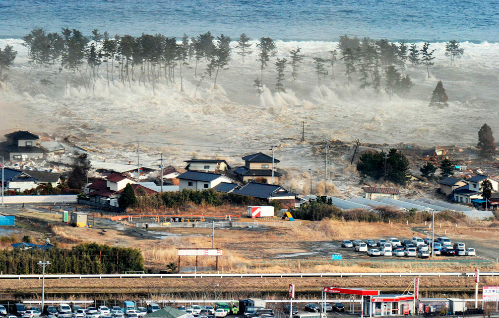 Photo at The Big Picture | Google Street View: the red building in the lower left |

Photo at The Frame | Google Map: triangular building in the foreground |
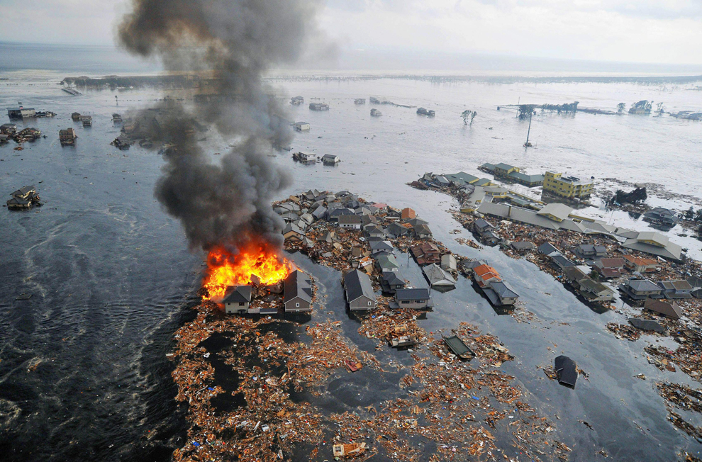 Photo at The Big Picture | Google Street View: area on fire behind houses |
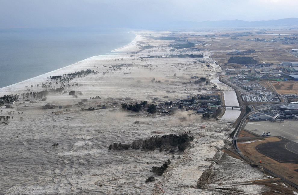 Photo at The Big Picture | Google Maps: area in view; camera is to the north, looking south |
 Photo at The Big Picture | Google Map: Sendai Airport's tarmac |
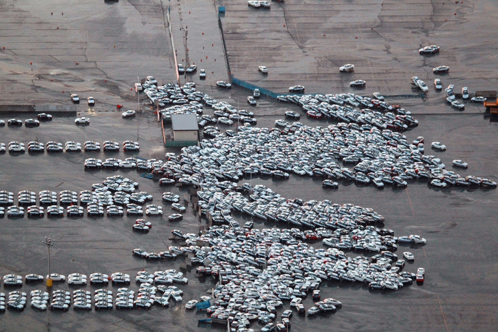 Photo at The Big Picture |
Google Map: car staging area
(just a guess on the location, but looks right) |

Photo at The Frame | Google Map: Sendai Train Station |
| And if you've seen the video from the helicopter that I mentioned yesterday, of the tsunami's relentless march over the rural villages and farmland, approaching a road with traffic, you'll have noticed the truck stopped on the edge of a bridge with a man on top watching events unfold. The location of the man and his truck is here, from which then you can see the whole area affected. | |
UPDATE: Google now has some post-tsunami imagery overlays for Google Earth, here and here.
UPDATE: NYTimes has an interactive before/after photo presentaiton.
Leave a comment...
Thank you very much for sharing the aerial maps/photos.
Hope the nuclear plants’ problems will be overcomed soon.