I recently heard about a very hard climb — over 3km/2mi at an average of almost 16% — not too far away. Many cyclists could not climb for 50m at 15%, much less do it for 3,000m. It's just ridiculously steep. This climb sounded to rival one the most difficult climbs in Japan, Kuragari West, which clocks in at 2.3km/1.7mi @ 17.3%.
Of course, I had to go check it out. It was quite the adventure.
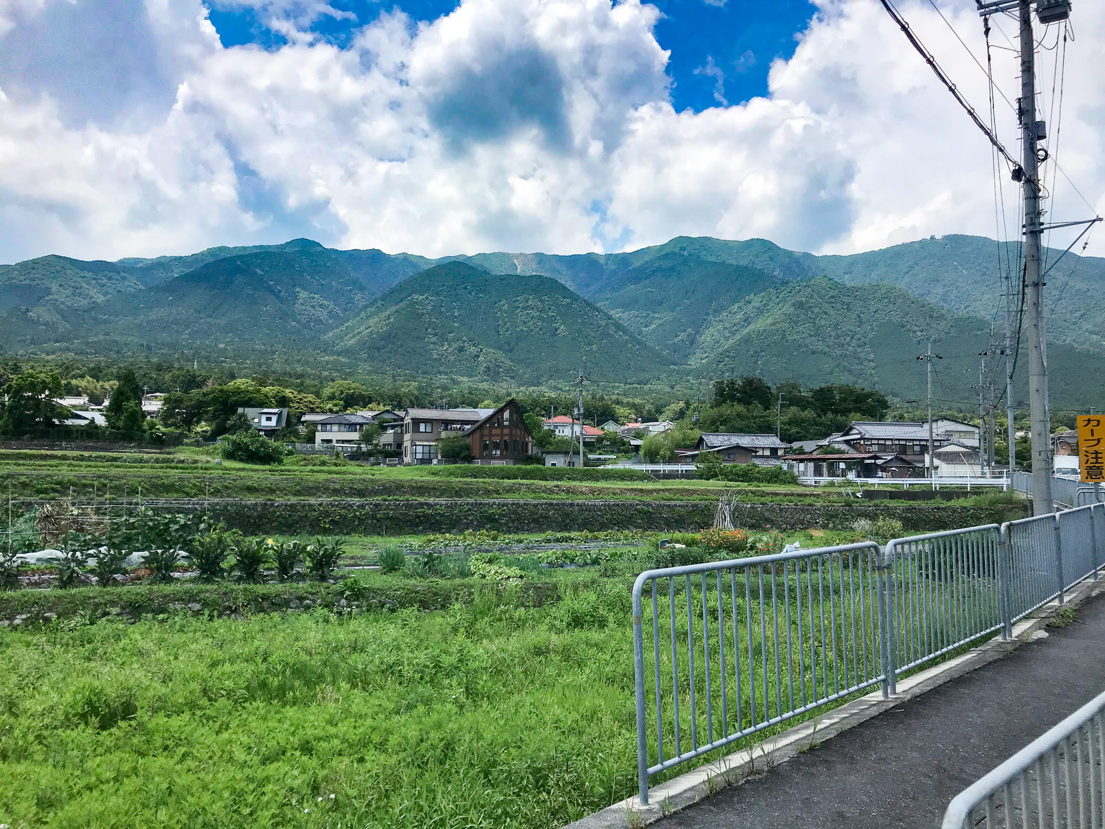
The start of the climb was about 30km north of Kyoto, along the shore of Lake Biwa. To save energy for the hard climb, I took the easiest route I could think of to get there.
iPhone 7 Plus f/1.8 at an effective 28mm — 1/3200 sec, f/1.8, ISO 20 — map & image data — nearby photos
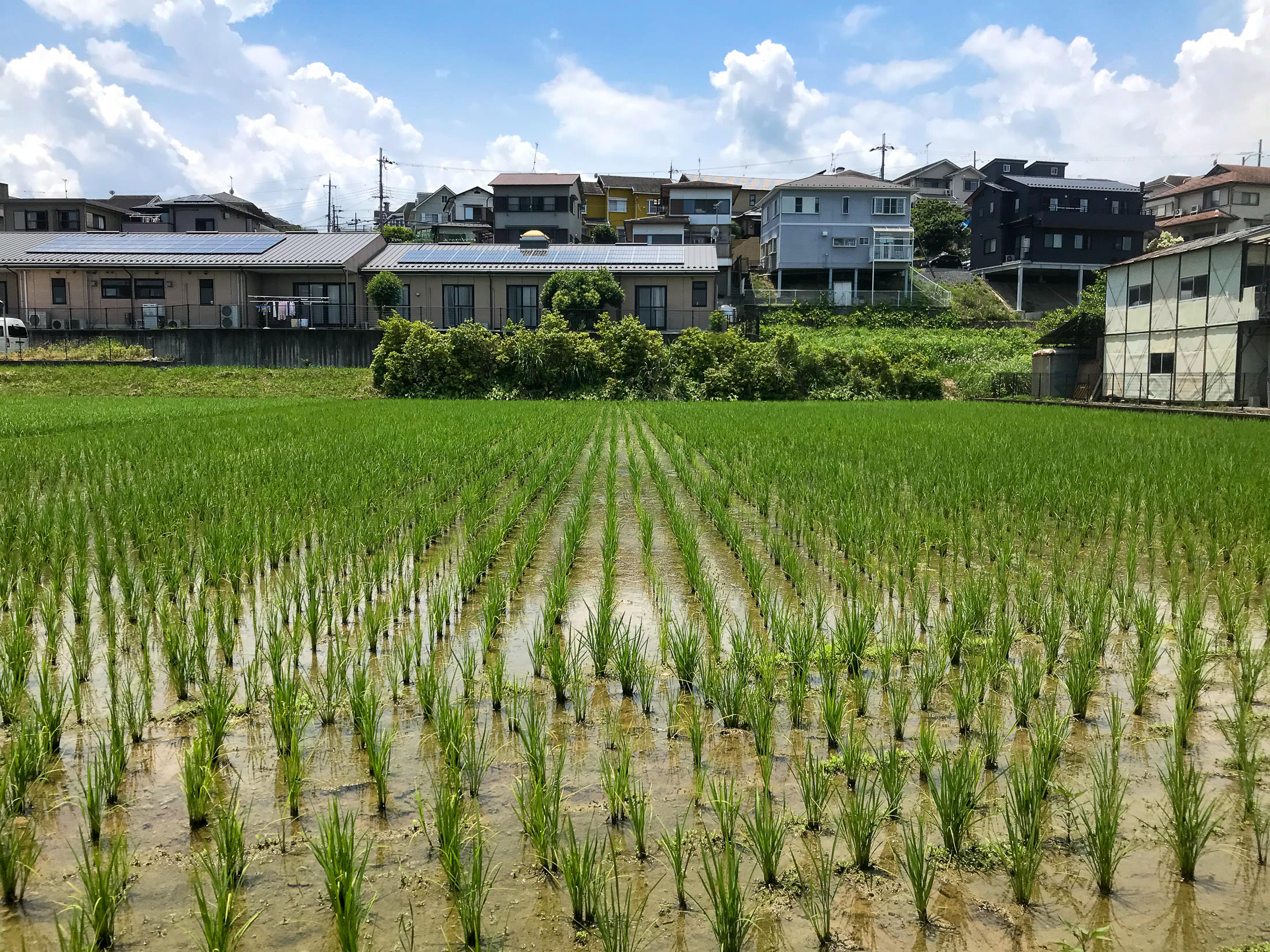
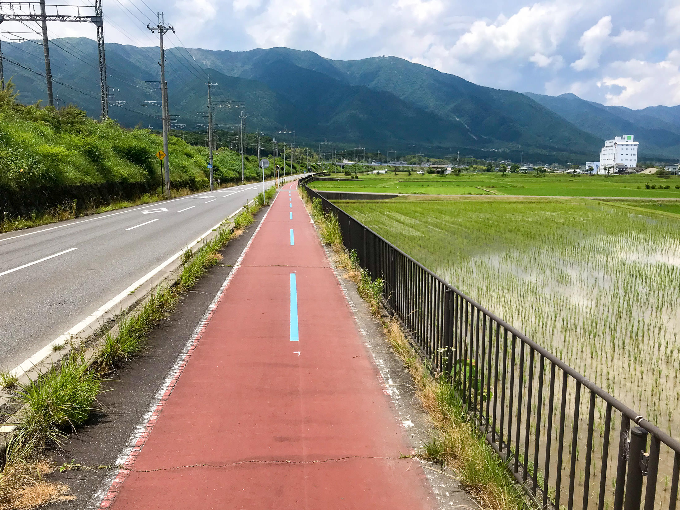
Pretty Views Along the Way
iPhone 7 Plus f/1.8 at an effective 28mm — 1/2300 sec, f/1.8, ISO 20 — map & image data — nearby photos
iPhone 7 Plus f/1.8 at an effective 28mm — 1/2900 sec, f/1.8, ISO 20 — map & image data — nearby photos
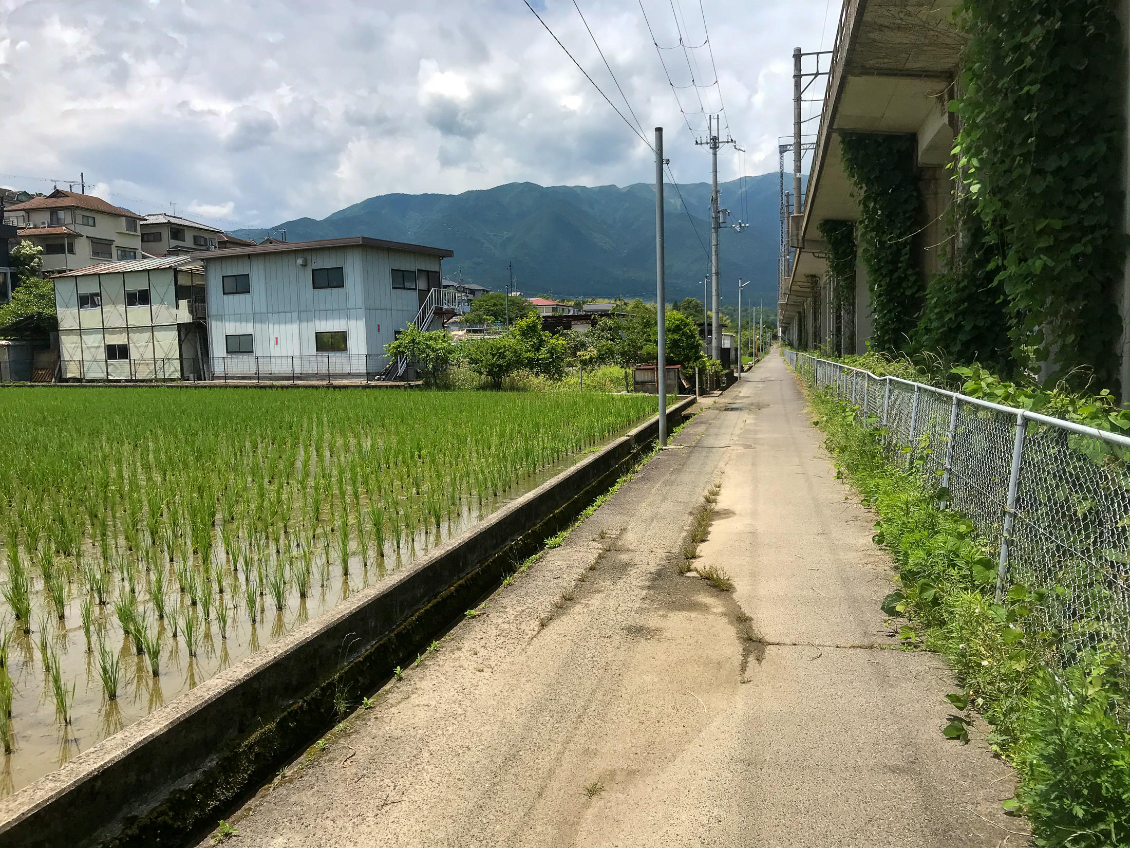
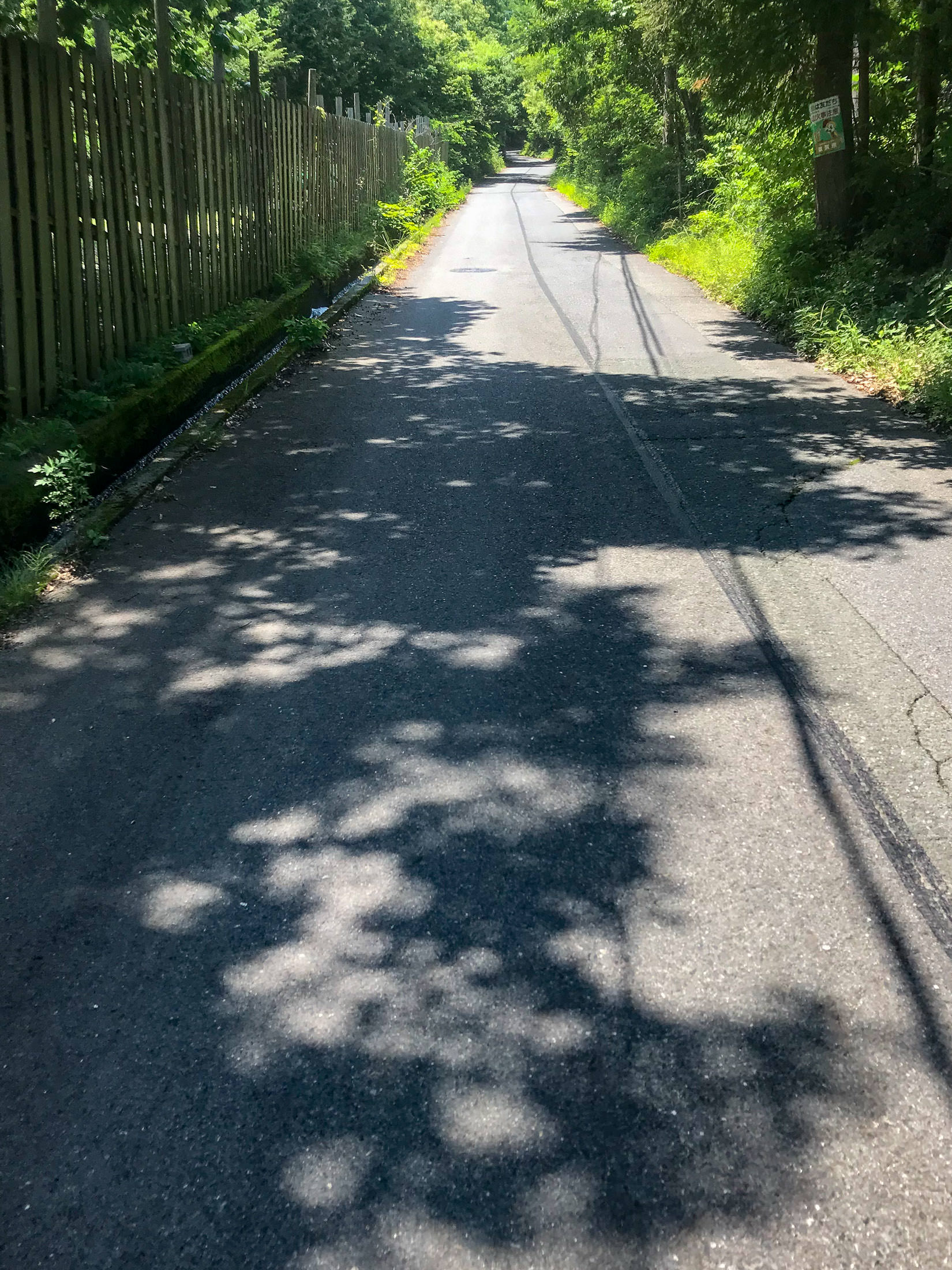
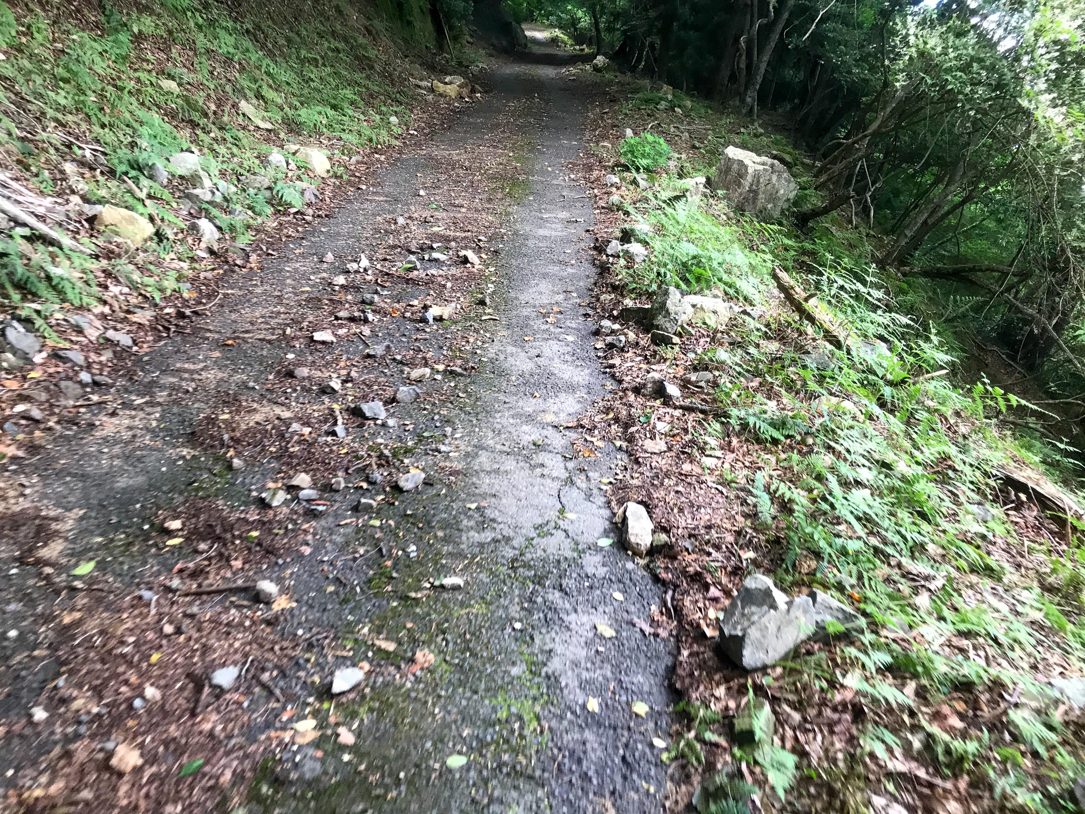
Bicycle Path
The path was much bumpier than the road. I would have preferred the road.
iPhone 7 Plus f/1.8 at an effective 28mm — 1/2000 sec, f/1.8, ISO 20 — map & image data — nearby photos
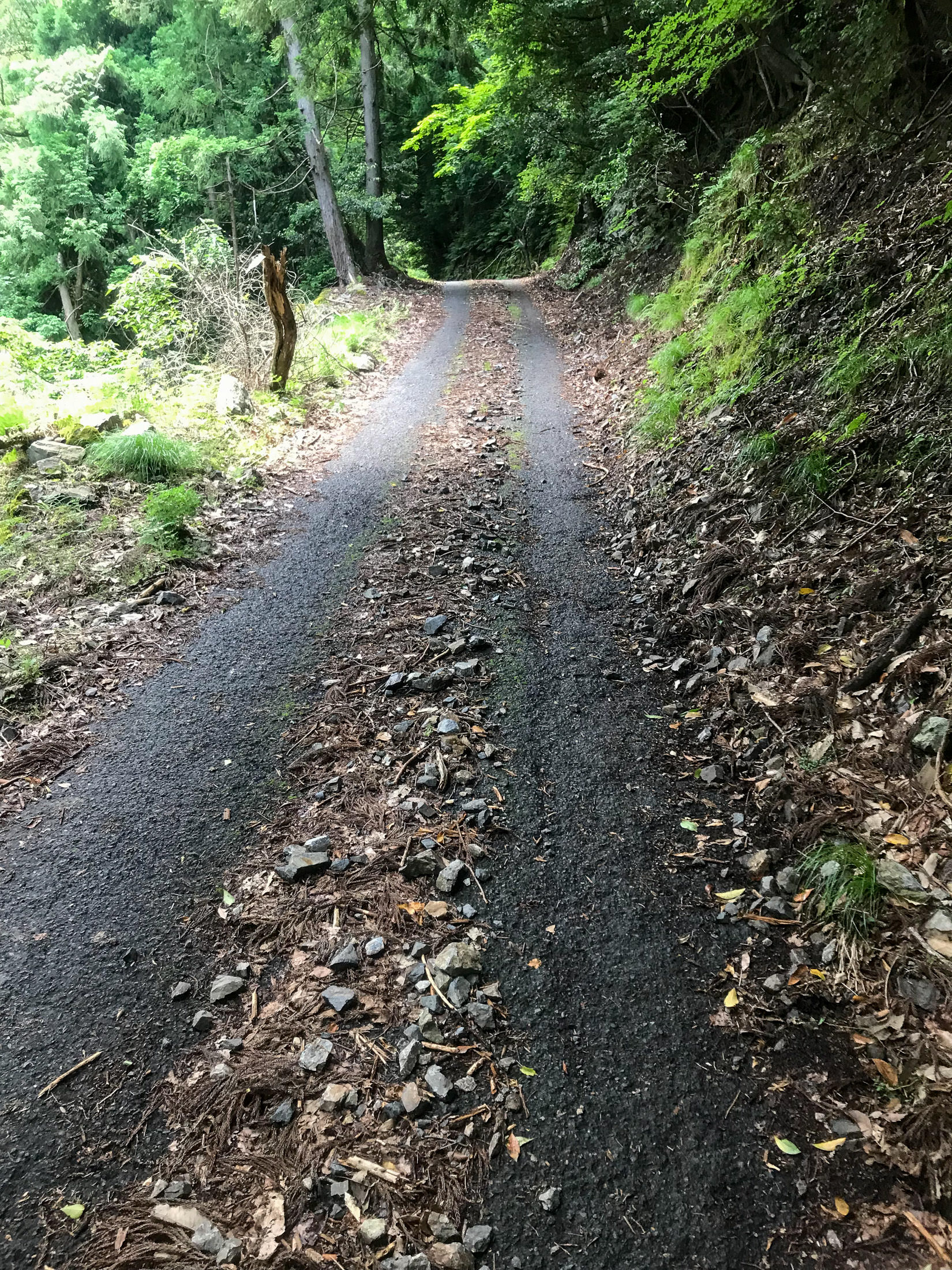
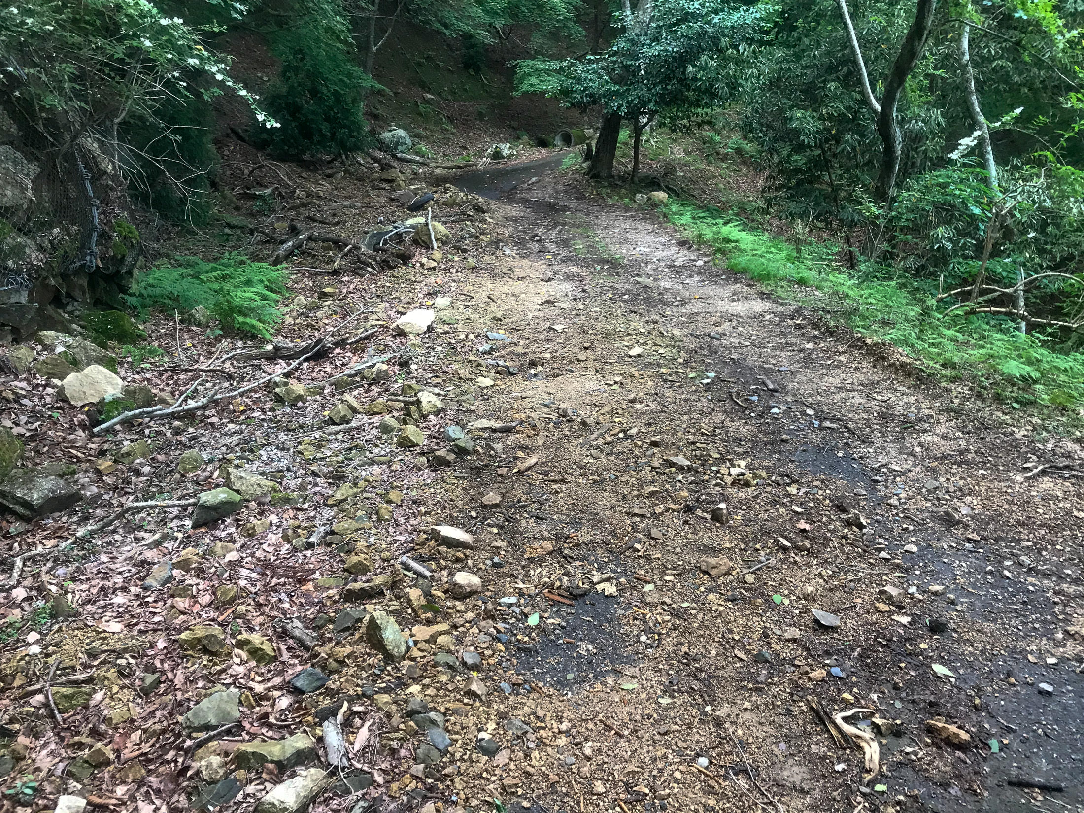
Getting Near the Start of the Climb
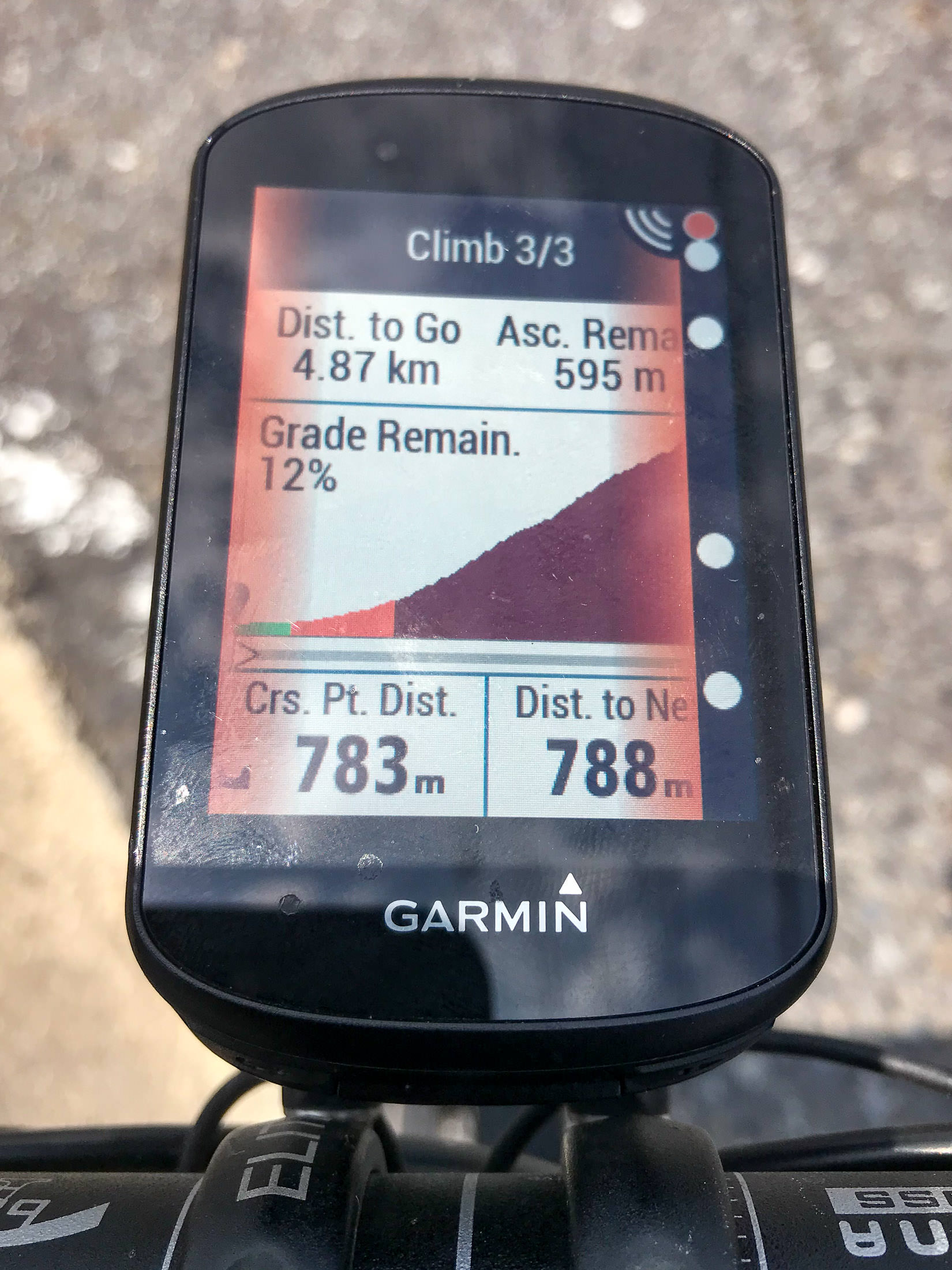
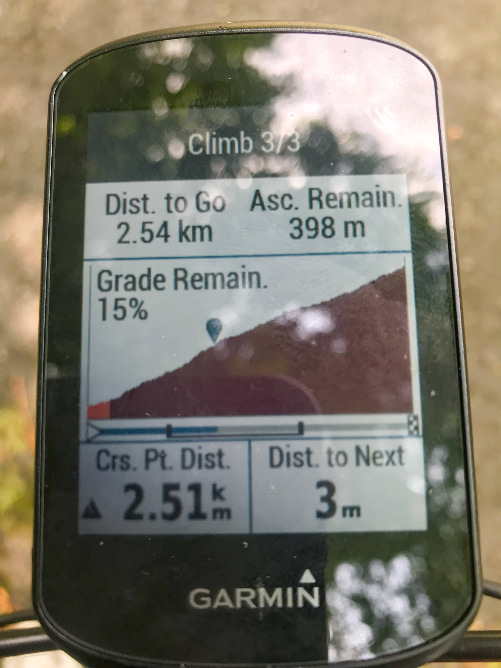
Modern Garmin cycling computers have a “Climber Pro” feature that notices where climbs are in a route, and highlights them like this. In this case, the mild lead up to (what I considered to be) the climb is included here, increasing the length to 4.9km and reducing the average grade to “only” 12%.
iPhone 7 Plus f/1.8 at an effective 28mm — 1/3400 sec, f/1.8, ISO 20 — map & image data — nearby photos
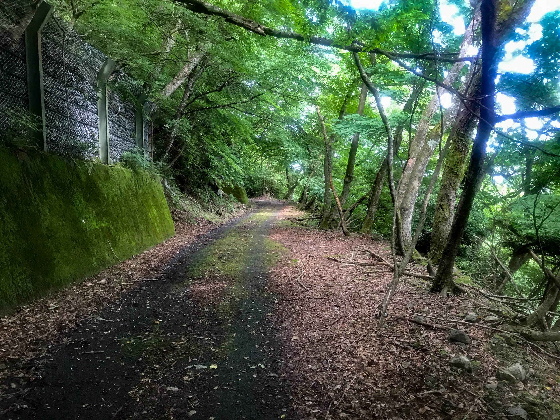
I'm Going Somewhere Up There
iPhone 7 Plus f/1.8 at an effective 28mm — 1/1900 sec, f/1.8, ISO 20 — map & image data — nearby photos
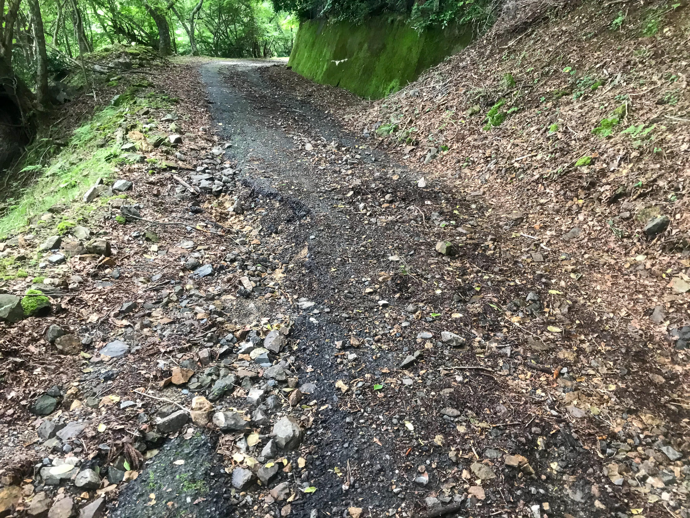
The Road Up Starts Here
Even though the road starts here, and starts going up right away, I found out later that the considered start of the climb is 350m farther on, at this shrine gate:
iPhone 7 Plus f/1.8 at an effective 28mm — 1/140 sec, f/1.8, ISO 20 — map & image data — nearby photos
Start of the Climb
at an elevation of 126m
The reason it starts here, rather than 350m back at the turnoff, I was told, is that 1) this is where it starts to get steep, rising at more than 10%, and 2) it's where the village ends, meaning that starting here avoids speeding cyclists annoying the elderly in the village.
iPhone 7 Plus f/1.8 at an effective 28mm — 1/640 sec, f/1.8, ISO 20 — map & image data — nearby photos
Straight Up at 13%
Within minutes, you're going straight up at 13%, which is not that bad.... until you realize that this is just the mild warmup for the kilometers of much worse to come.
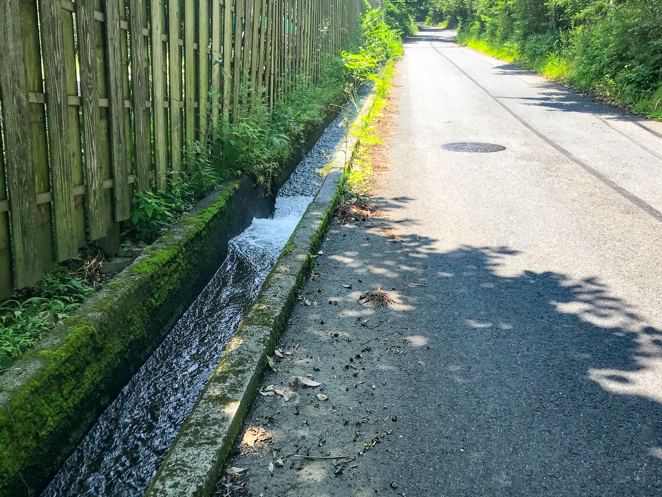
One nice thing I noticed is that for much of the start of the climb, clean water is positively rushing down the gutter next to the road. It looked very clean and inviting. I'm sure that this is drinkable, so that means that you don't really need to bring a lot of water with you, even during the hottest days of summer.
iPhone 7 Plus f/1.8 at an effective 28mm — 1/490 sec, f/1.8, ISO 20 — map & image data — nearby photos
Drinkable Water
rushing down at breakneck speed
The road surface is very good here. I had been told by one person that the road pavement was good until just before the end, and by another person that it was so bad that it was one of the most dangerous roads to cycle on in the area. So far, it looked really good.
The quality of the pavement is very important for steep climbs on a road bike, because there are two real dangers that can happen if the rear wheel loses traction. One is that as you're pushing down hard on the pedal trying to overcome gravity and lift you and the bike up the mountain, suddenly there is no resistance and you can find yourself flying over the handlebars, or (for men) have a particularly unpleasant impact injury.
The other is that if the wheel slips, you lose forward momentum, and unless you can very quickly unclip your shoes from the pedals, you will fall over. I have not done this.... recently.
Things that can cause the rear wheel to lose traction on a steep climb: wet pavement, rough pavement, moss on the road (on a steep road, moss is death), sand/rocks/pebbles on the road, potholes, branches, leaves. Or, more commonly, many combinations thereof.

iPhone 7 Plus f/1.8 at an effective 28mm — 1/60 sec, f/1.8, ISO 20 — map & image data — nearby photos
Looks Steep
Garmin cycling computers have long had an “Elevation” screen that shows either the elevation it thinks you've done so far, or, if you're following a course that has elevation data, a forward-looking graph of the elevation and where you are now, as seen above.
One used to be able to adjust both the vertical and horizontal scale of the graph, but for inexplicable reasons, in the current state-of-the-art Edge 530 model that I have, they don't allow the vertical scale to be adjusted. That makes small hills essentially disappear (look flat), an horrible monster hills like the one I'm climbing now look merely “steep”. Sigh. The “Elevation” screen is not even mentioned in the manual. Sigh. Garmin units are really horrible, but they're still better than anything else out there. Sigh.
iPhone 7 Plus f/1.8 at an effective 28mm — 1/120 sec, f/1.8, ISO 40 — map & image data — nearby photos
The “Climber Pro” Screen
iPhone 7+ + iPhone 7 Plus front camera 2.87mm f/2.2 at an effective 32mm — 1/60 sec, f/2.2, ISO 25 — map & image data — nearby photos
Totally Soaked in Sweat
All the photos from now on are a bit hazy, because my phone was in my jersey pocket, and my jersey was completely soaked. I didn't have anything to clean the lens with.
It was my intention to take this climb very slowly, and to stop on occasion so as to not overdo it this first try. Frankly, I don't know whether I could do this whole climb without stopping with the road-bike gearing that I had. It'd be much easier with mountain-bike gearing. In any case, I took the opportunity to take photos, or, more honestly, I took the occasion of taking photos to stop and rest.
iPhone 7 Plus f/1.8 at an effective 28mm — 1/25 sec, f/1.8, ISO 40 — map & image data — nearby photos
Still Not Too Bad
but with the crazy steepness, one had to pick a line carefully
iPhone 7 Plus f/1.8 at an effective 28mm — 1/20 sec, f/1.8, ISO 40 — map & image data — nearby photos
More Challenging
only one thin strip of clean road
iPhone 7 Plus f/1.8 at an effective 28mm — 1/500 sec, f/1.8, ISO 20 — map & image data — nearby photos
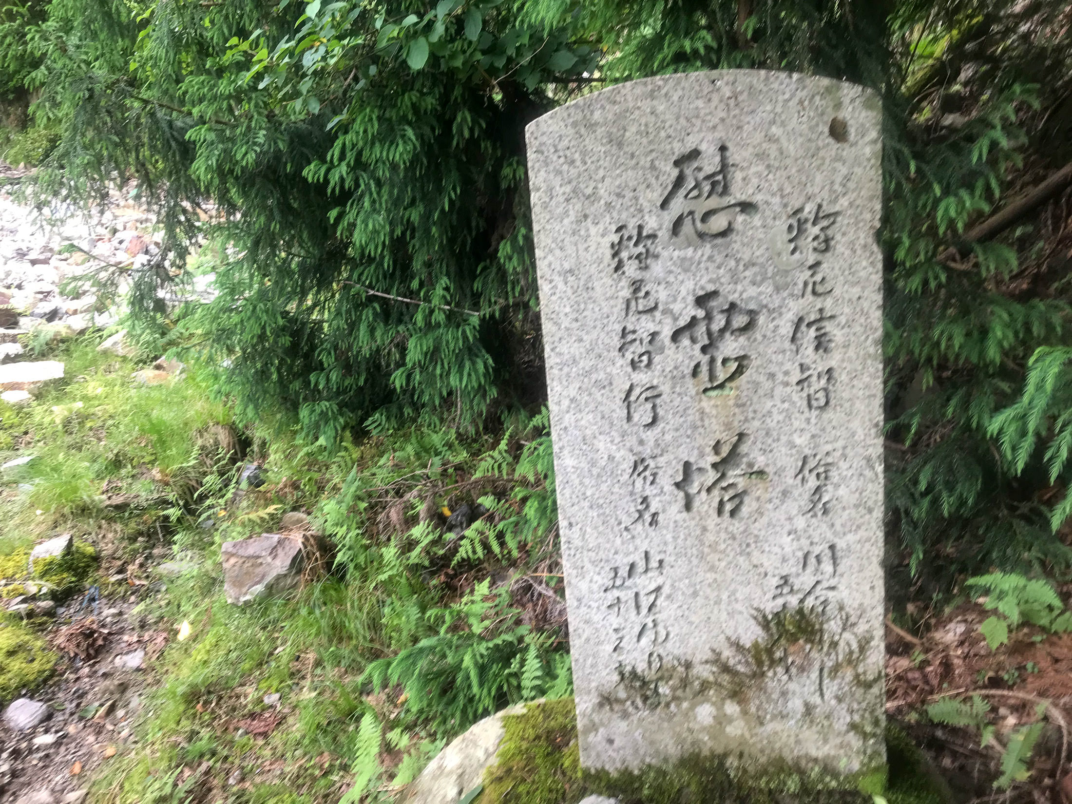
Entrance to the Konpira Shrine
金比羅神社
At one point I came around a corner to find what looks to be the entrance to the Konpira Shrine. Or, what we see is all that there is of the shrine? (I could see nothing up the mountain behind it.) I dunno.

iPhone 7 Plus f/1.8 at an effective 28mm — 1/530 sec, f/1.8, ISO 20 — map & image data — nearby photos
This is All I Could See
iPhone 7 Plus f/1.8 at an effective 28mm — 1/560 sec, f/1.8, ISO 20 — map & image data — nearby photos
Ridiculously Steep
right at the shrine
As you can see in the photo above, the road surface is great, but as the road goes up after passing the shrine, it gets very steep (approaching 20%), and suddenly has a lot of moss:
iPhone 7 Plus f/1.8 at an effective 28mm — 1/30 sec, f/1.8, ISO 32 — map & image data — nearby photos
Forced Stop
at 20%
This was the first time (but not the last time) that I had to stop suddenly because the road, and my situation on it, was not safe. As became more and more common, the center of the road was a thick strip of gunk, with strips of vaguely-clean area left by car tires. I was in the left-side strip on a painfully-steep section of road, when suddenly that left-side strip was covered in slippery moss. The gunk in the center was too much for me to try to cross over to the right side (remember, this is extremely steep), so I quickly stopped before a slipping wheel and gravity did it for me. I then moved over to the right side, and snapped this photo.
I wasn't able to start pedaling again. Believe me, I tried, but it was just too steep and slippery. I didn't want to walk (I have some pride), so I just inched forward by pushing down on one pedal repeatedly. This was perhaps the steepest section of road.
iPhone 7 Plus f/1.8 at an effective 28mm — 1/30 sec, f/1.8, ISO 25 — map & image data — nearby photos
Getting A Little Better
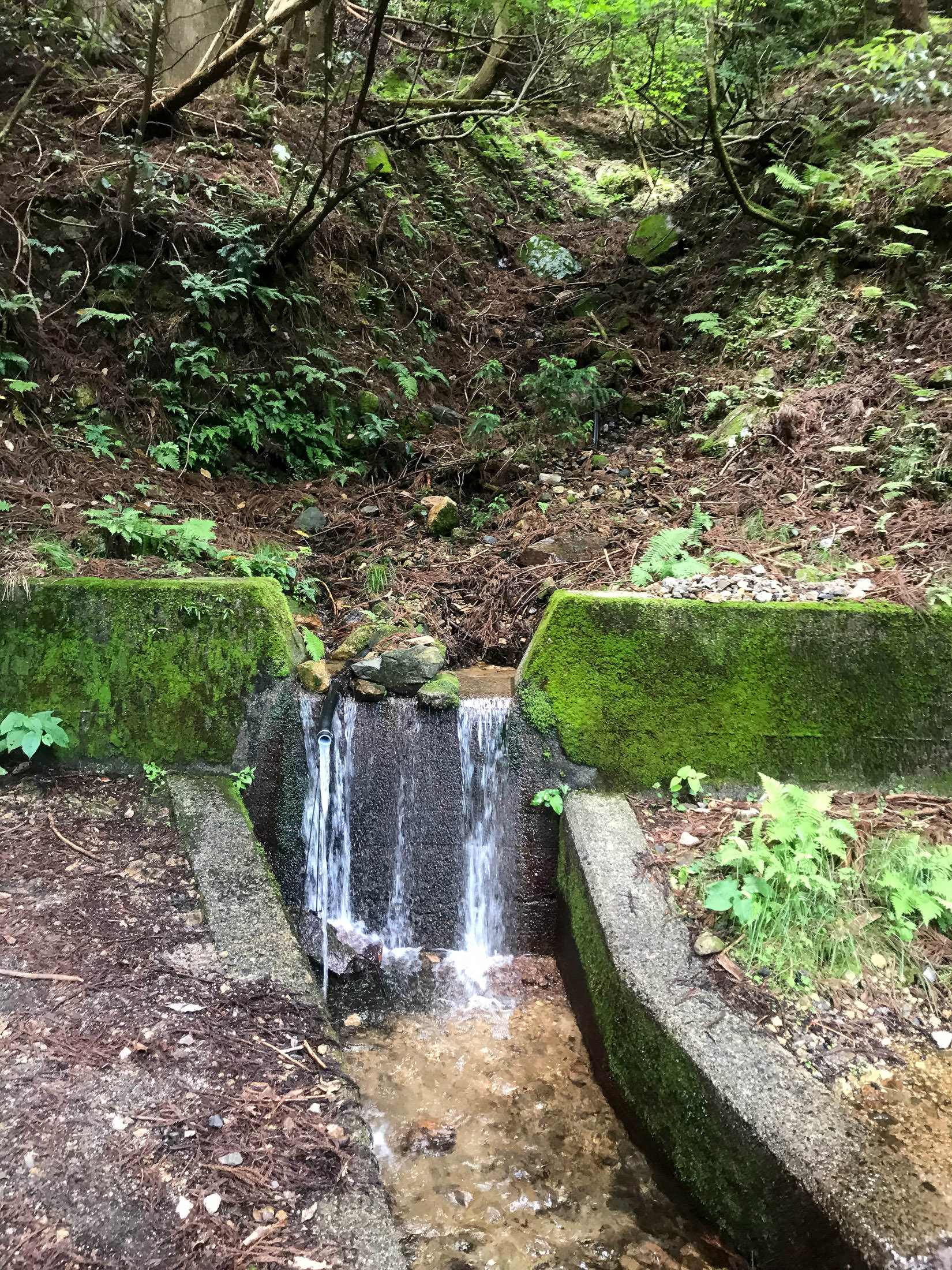
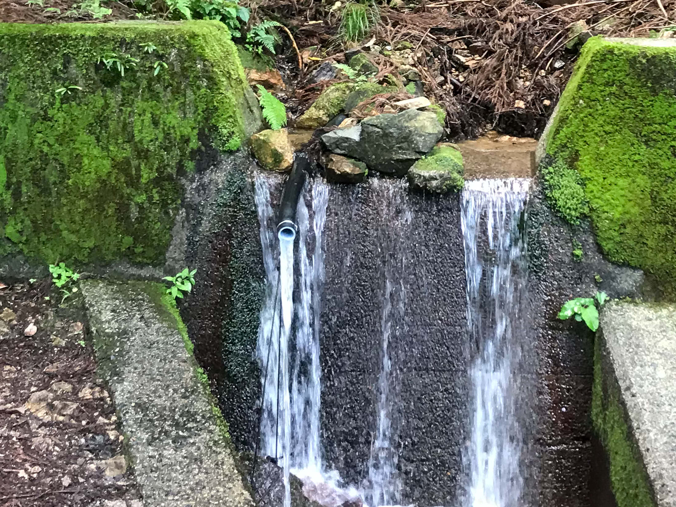
A couple of minutes later, I came across a spring by the side of the road:
iPhone 7 Plus f/1.8 at an effective 28mm — 1/15 sec, f/1.8, ISO 40 — map & image data — nearby photos
iPhone 7 Plus f/1.8 at an effective 28mm — 1/15 sec, f/1.8, ISO 40 — map & image data — nearby photos
That Pipe is It
Konpira Shrine Pure-Water Spring
金比羅神社名水
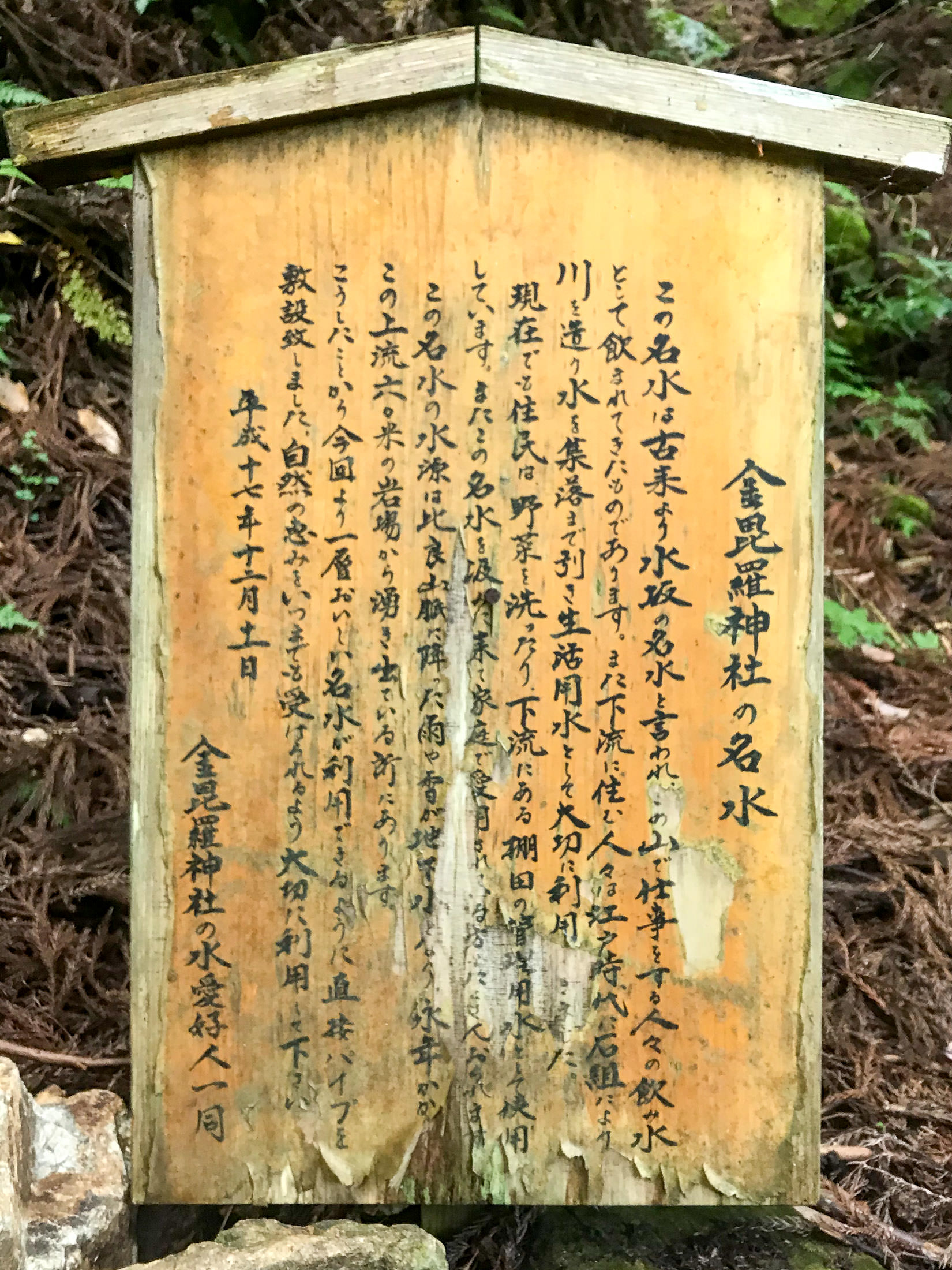
iPhone 7 Plus f/1.8 at an effective 28mm — 1/17 sec, f/1.8, ISO 40 — map & image data — nearby photos
Description
which I can't read
I was so tired by this point that I didn't actually read the sign that I took a photo of, so I didn't realize that this was the spring. I knew that there was a spring on this route, but Google Maps had it at the very top where the road ended (another 1.2km distant, 175m up). It turns out that Google Maps was wrong, and I've since fixed it.
According to what I've learned since, the pipe goes about 80m up to the source of the spring. The spring produces the same amount of water regardless of what's happening in the weather: the water that comes out of the spring is said to have been in the mountain for 100 years, and that if it never rained again, the spring would still flow for 100 years.
In any case, I was happy to get some more water, and I discarded the remaining convenience-store bottled water that I had in preference for this. It was very tasty.
And then I continued on.
iPhone 7 Plus f/1.8 at an effective 28mm — 1/30 sec, f/1.8, ISO 25 — map & image data — nearby photos
Not Good
on one of the steepest sections
iPhone 7 Plus f/1.8 at an effective 28mm — 1/30 sec, f/1.8, ISO 25 — map & image data — nearby photos
I Walked This Little Section
I didn't want to get a puncture on the rocks

iPhone 7+ back camera at an effective 57mm — 1/1000 sec, f/2.8, ISO 20 — map & image data — nearby photos
Nice View
the one and only sweeping view on the whole climb
iPhone 7 Plus f/1.8 at an effective 28mm — 1/15 sec, f/1.8, ISO 40 — map & image data — nearby photos
Nope
I think I walked past this section, too
Past the spring, the road got increasingly bad in every respect. When the road is so bad that you have to dismount to walk past danger zones, it's not really fun. Again, it'd be fine on a mountain bike, I imagine, but I had to stop many times to work my way around dangerous sections.
iPhone 7 Plus f/1.8 at an effective 28mm — 1/30 sec, f/1.8, ISO 32 — map & image data — nearby photos
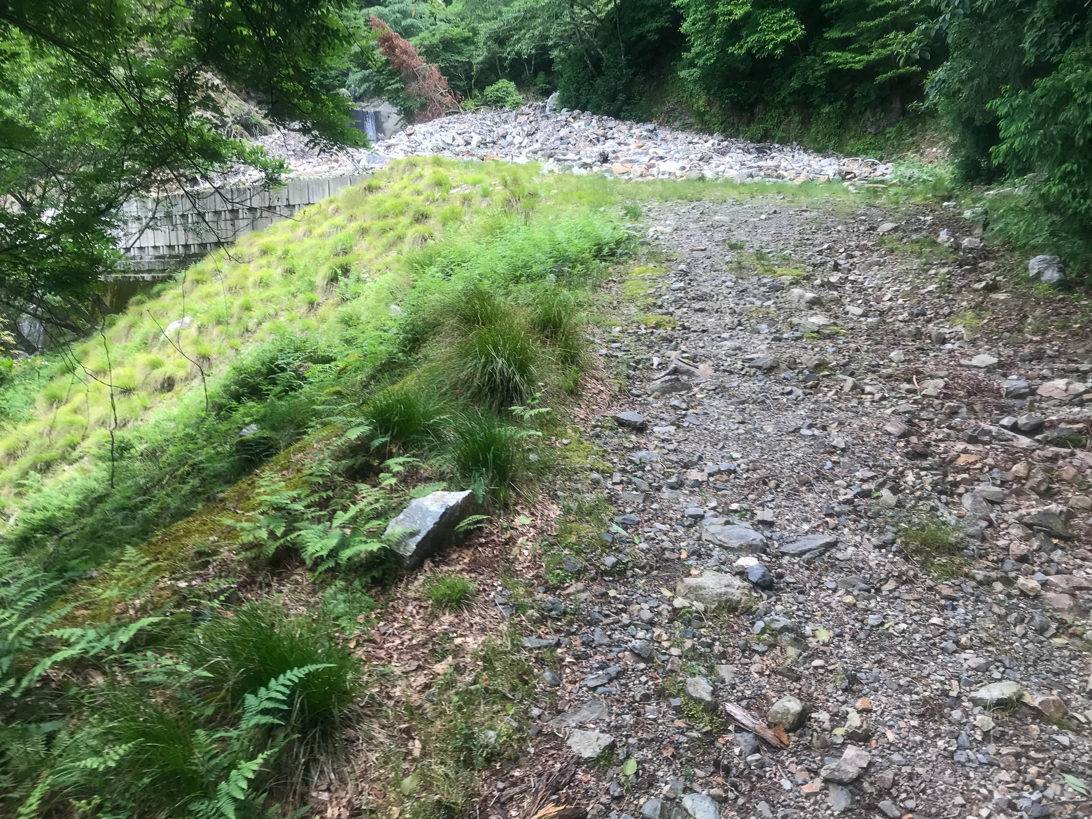
A Suddenly-Nice Section
the moss is not so fun, but it can be mostly avoided
iPhone 7 Plus f/1.8 at an effective 28mm — 1/200 sec, f/1.8, ISO 20 — map & image data — nearby photos
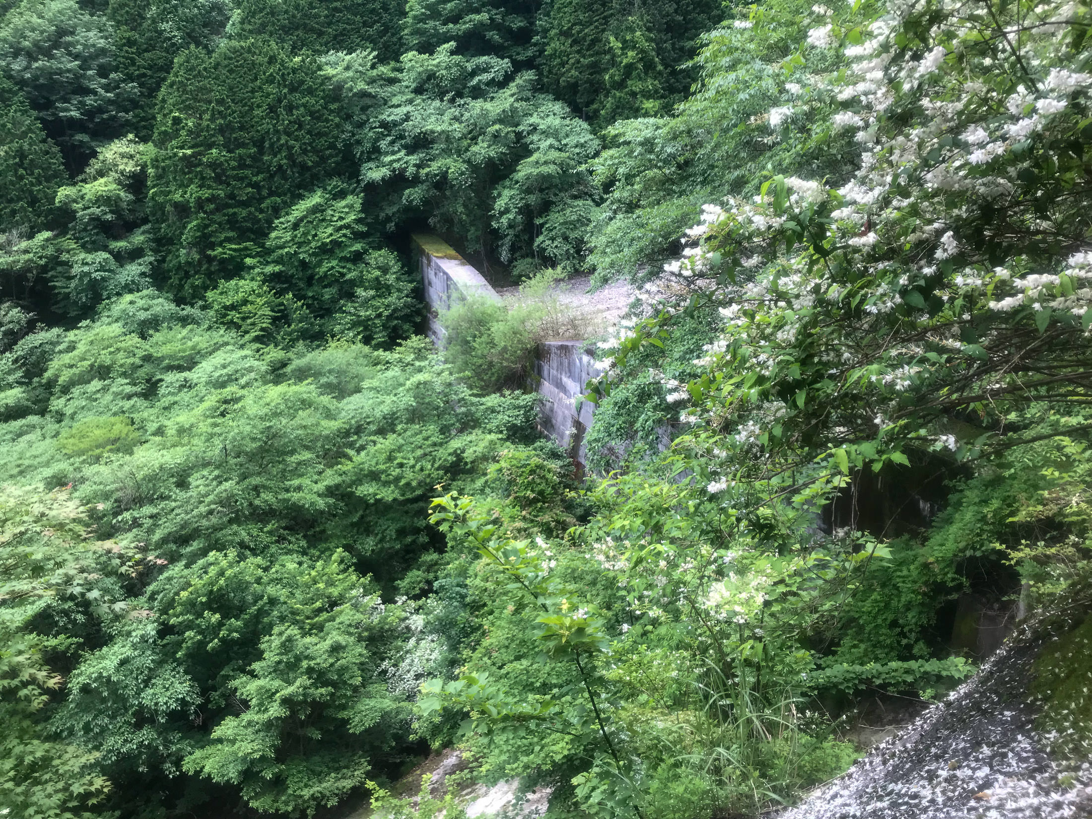
Biggest Dam
of the many dams up and down the road-side river, this was the largest
Nearing the end, the road gave up all pretense of being paved.

iPhone 7 Plus f/1.8 at an effective 28mm — 1/30 sec, f/1.8, ISO 40 — map & image data — nearby photos
Concrete
it looks like a bunch of cars drove through freshly-poured concrete
The ruts here were very deep, and I walked over this whole section. And remember, it's still ridiculously steep.
iPhone 7 Plus f/1.8 at an effective 28mm — 1/30 sec, f/1.8, ISO 40 — map & image data — nearby photos
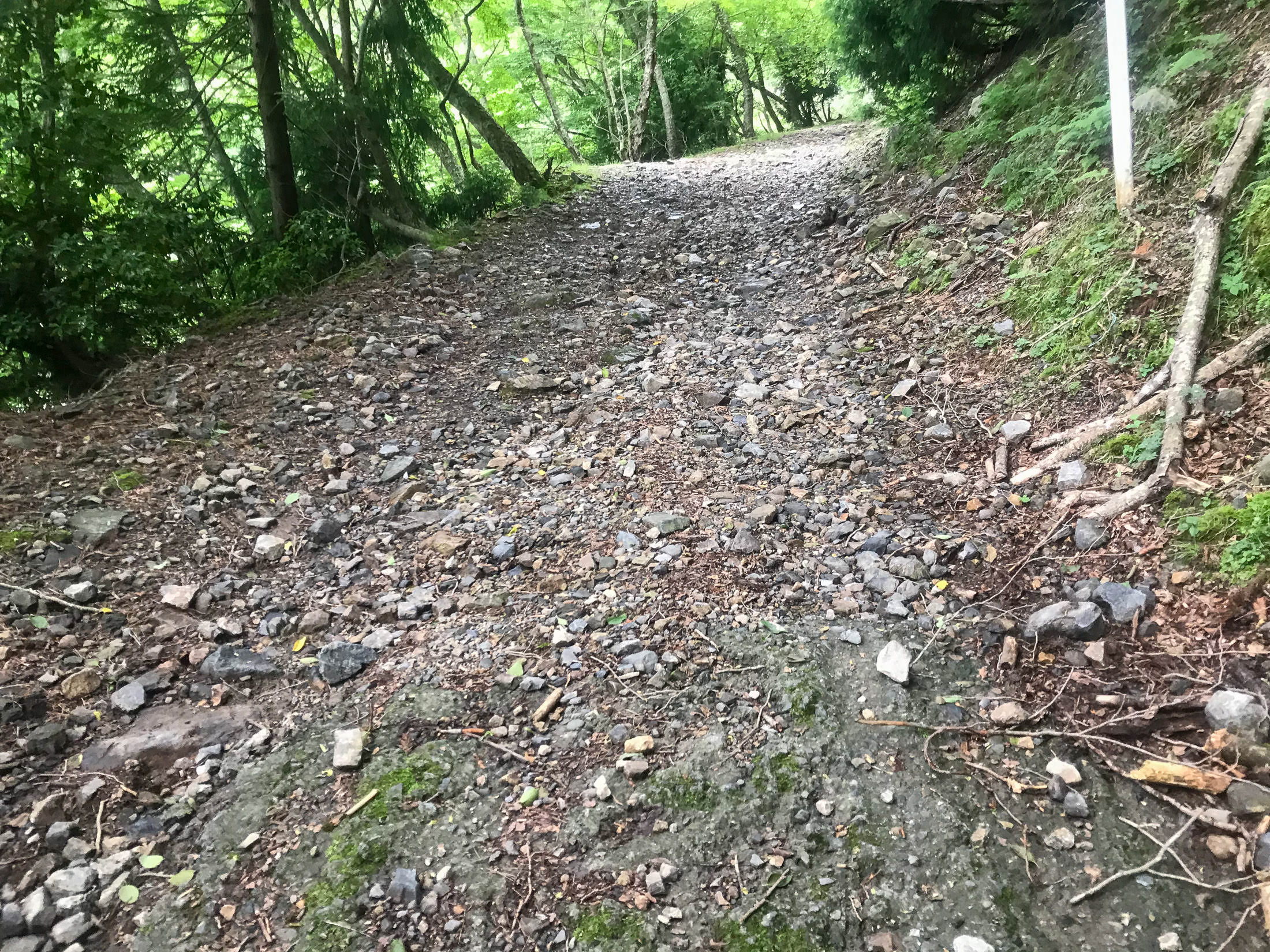
This is the “Road”
iPhone 7 Plus f/1.8 at an effective 28mm — 1/30 sec, f/1.8, ISO 32 — map & image data — nearby photos
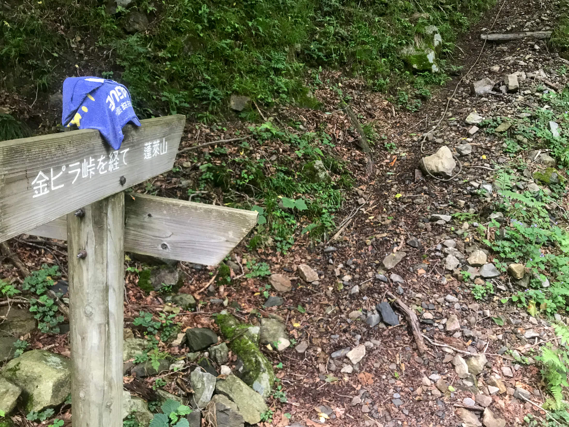
Entrance to a Hiking Trail
the rope in the upper right is to help people pull themselves up
( I wish I could capture the sense of steepness in photos )
According to one Strava segment, it took me 54 minutes to get here from the bottom. The fastest recorded time is 27 minutes, by a guy in 2013 back when the road was presumably in a better state. Given the current state of the road, I don't know that I could have done it in 27 minutes on my scooter. A mountain bike or a dirt bike would be better.
I tend to enjoy challenging myself on extremely-steep climbs, but even if the road surface had been pristine, I don't think I could have done this one without stopping. The combination of me and the bike is well over 100kg (about 6kg being winter flab that I'm trying to lose), so I'm almost 2x the weight of real climbers. It's just too difficult for me now.
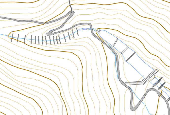
But the road was not pristine, and that takes all the fun out of it. In this case, the quality deteriorated more and more over time, so a clear, safe, apparent “let's consider this to be the end” location didn't present itself. This bothered me because I had been planning to make a surveyed segment for this climb.
Strava segments are normally made by users after they've ridden a ride, and that user's GPS data becomes The Master Data for the segment. Unfortunately, that data can be horrible, because consumer GPS units can be wildly inaccurate, especially in the mountains. Heck, I've seen a short segment on a totally flat road in the city presented as a 28% climb, because the user that made the segment had stopped into a cafe along the line, and the weather had changed while stopped, so when restarting their cycling unit, the barometric altimeter thought they had suddenly climbed a mountain, even though they hadn't even moved.
I talk about it in detail in “Strava Segment Tutorial: Removing Suckage and Promoting Quality”, but in short you often can't trust the map track, distance, and elevation data associated with a Strava segment, and that's a bummer. To counter this, I make computer-generated segments using highly accurate road and elevation data from the Japanese government.
I've made more than 2,400 such “Surveyed” segments so far, and I wanted to make one for this climb, but I couldn't figure out a good place to have the climb stop. If I were considering only mountain bikes, I'd stop here at the entrance to the hiking trail, but I also want to consider road bikes. If only the road surface was good the whole way. As it was, I was bummed and disillusioned about this climb.
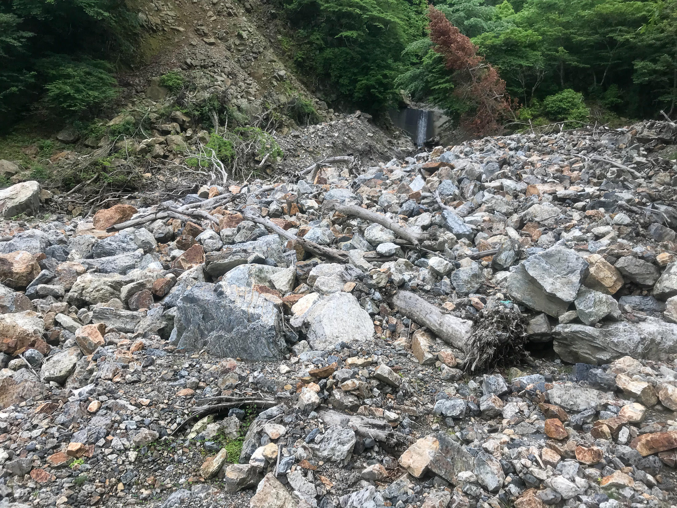
I left the bike and continued on foot for a bit to see the big rockfall that I knew to be just above...
iPhone 7 Plus f/1.8 at an effective 28mm — 1/180 sec, f/1.8, ISO 20 — map & image data — nearby photos
iPhone 7 Plus f/1.8 at an effective 28mm — 1/60 sec, f/1.8, ISO 25 — map & image data — nearby photos
iPhone 7 Plus f/1.8 at an effective 28mm — 1/600 sec, f/1.8, ISO 20 — map & image data — nearby photos
Huge Rockfall
This huge rockfall is where the road nominally ends (though it actually ended some time before). I looked around for the spring, as I said, not having realized that the one halfway up was it.
I turned and headed down.
When I got near the bottom, I explored some small side roads. On one, I saw this lovely bicycle just sitting in the forest, with no other sign of human presence around except for me and the road:

iPhone 7 Plus f/1.8 at an effective 28mm — 1/120 sec, f/1.8, ISO 32 — map & image data — nearby photos
Odd
Later, I found a little road that went up to a small mountain community of a few dozen houses, including one Really Weird haunted-looking.... structure:

iPhone 7+ back camera at an effective 57mm — 1/540 sec, f/2.8, ISO 20 — map & image data — nearby photos

iPhone 7+ back camera at an effective 57mm — 1/200 sec, f/2.8, ISO 20 — map & image data — nearby photos
At first glance I thought it was a big concrete building in the process of being demolished, but as I got closer, I realized that the rough nature of some of the structure was clearly on purpose, and that perhaps it was in the process of being built. But it looked abandoned. It reminded me of a grotesque and low-budget version of the Winchester Mystery House.
Later, I asked a local resident about it. Apparently, some guy had just been building there over the years, at his whim (much like the Winchester Mystery House), but he had died so it's just been sitting. I asked how long ago, and he couldn't say except that it was before his time. I got the impression that it had been setting vacant for many decades.
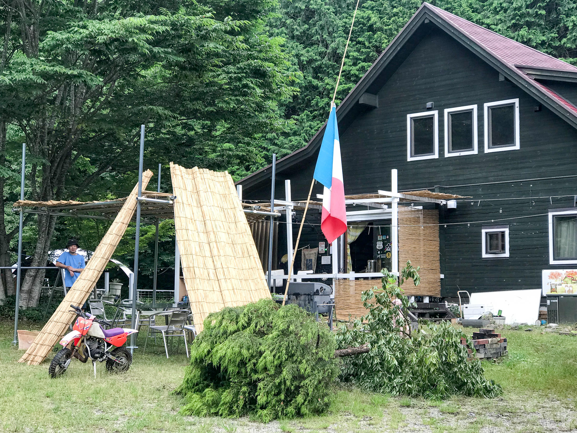
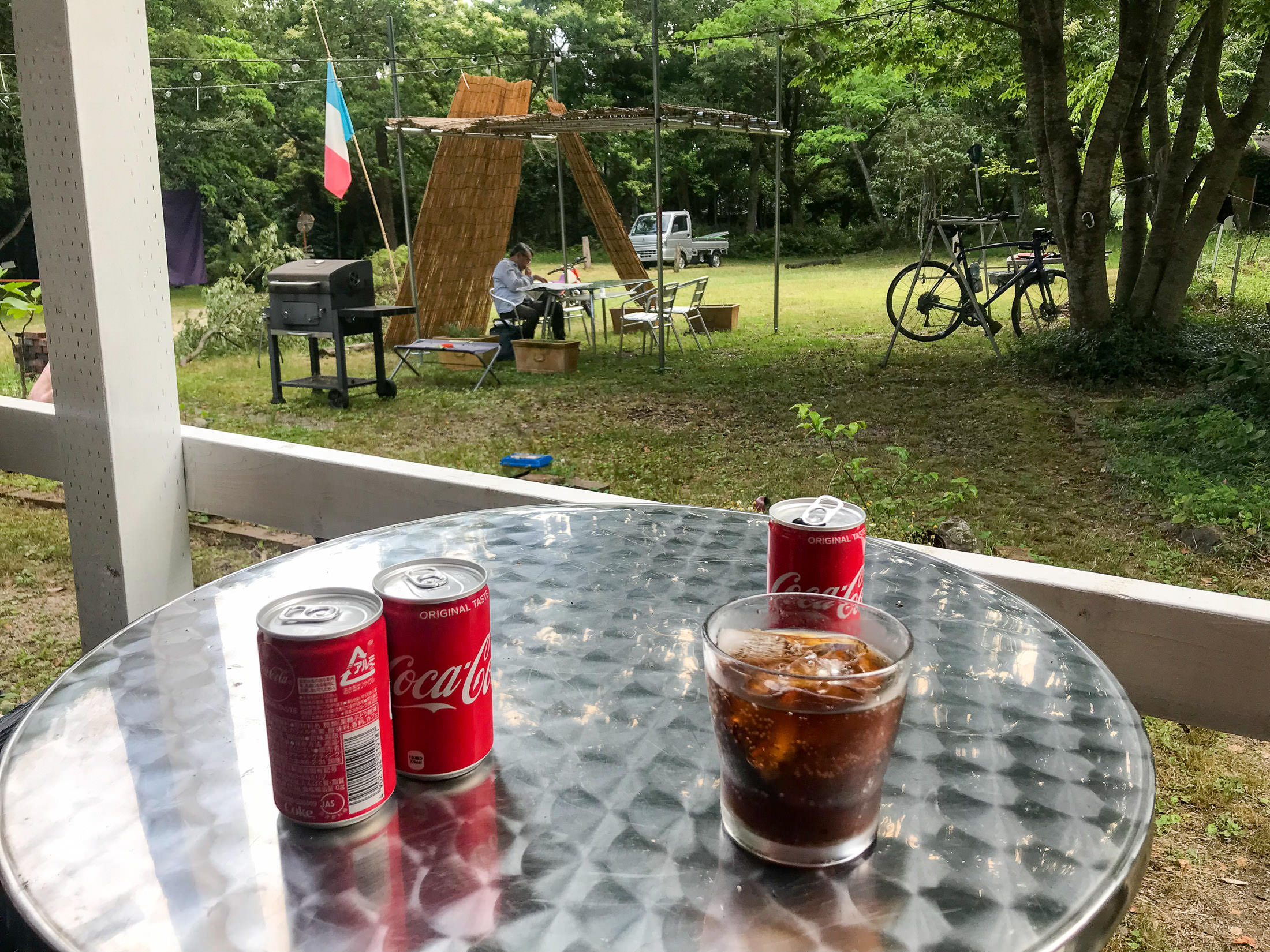
Then it was time for lunch. In preparing for the ride, I'd found a pizza place that looked promising, so I headed there.
iPhone 7+ back camera at an effective 57mm — 1/90 sec, f/2.8, ISO 32 — map & image data — nearby photos
FANTASISTA Pizza
Google-Map link
restaurant home page

iPhone 7 Plus f/1.8 at an effective 28mm — 1/120 sec, f/1.8, ISO 25 — map & image data — nearby photos
Entrance

iPhone 7 Plus f/1.8 at an effective 28mm — 1/210 sec, f/1.8, ISO 20 — map & image data — nearby photos
Cute
Judging from the restaurant's home page, I expected that the owner would be quite the character. He did not disappoint. Super interesting to chat with. He's an avid cyclist, motorcyclist, windsurfer, and go-kart racer.
He filled me in on a lot of info about the climb (which he guesses he's done more than a hundred times), the spring, Strava segments, the kind of people who ride there, etc. He says that most road cyclists stop at the spring, what's called a “half climb”. That made a lot of sense, since the road is mostly okay up to that point. The pre-existing Strava segment that goes all the way to the hiking-trail entrance has only 74 attempts registered, while the one to the spring has 476.
I ended up making a surveyed segment to the spring, “金比羅名水、鳥居から / Konpira Pure Spring, from Tori Gate [計測/Surveyed]”. Even though this is ostensibly the same exact route as the aformentioned “half” segment, it matches 490 efforts. The extra matches are because the source track is closer to reality.
Just to give an idea of the different quality of source tracks from which segments are made, here's an interactive demonstration for part of the climb up to the spring:
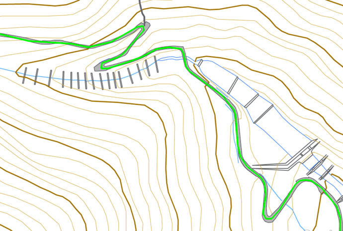
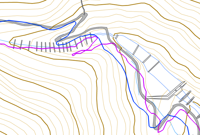
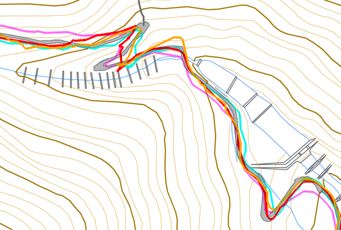
mouseover a button to see that image
iPhone 7 Plus f/1.8 at an effective 57mm — 1/12 sec, f/1.8, ISO 100 — map & image data — nearby photos
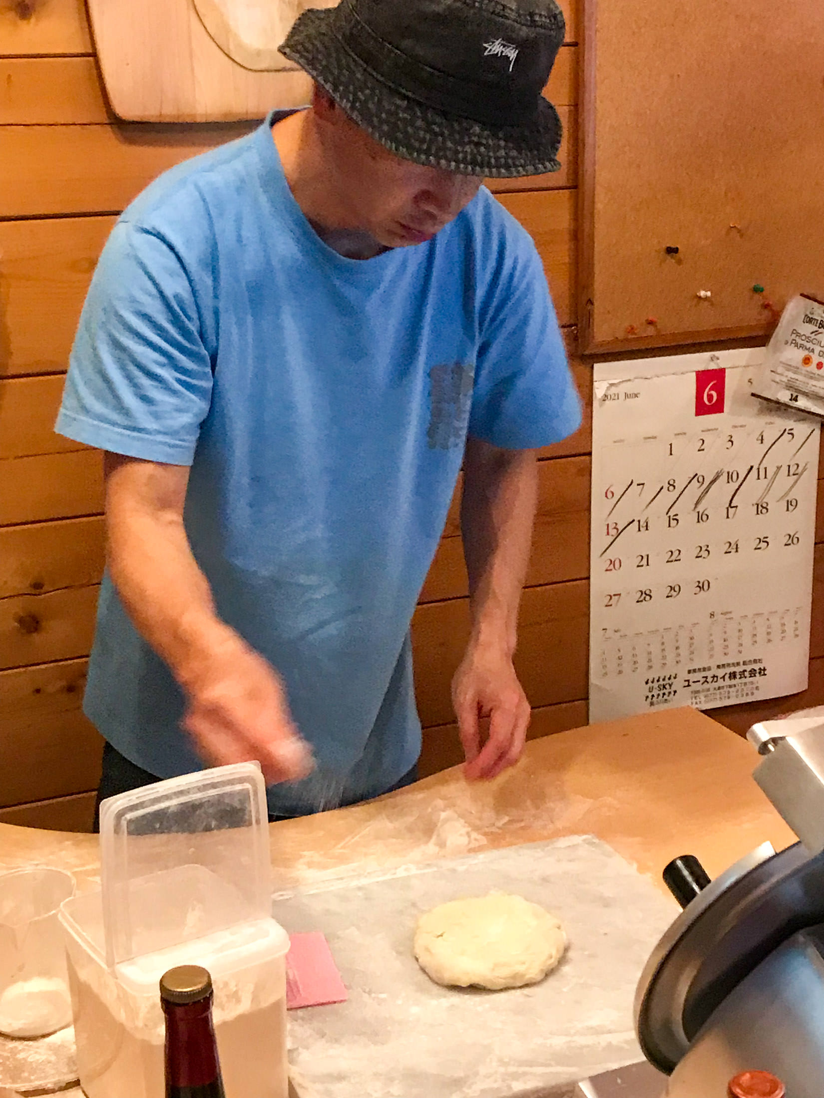
Junpei Starts on My Pizza
While the onwer, Junpei, made my pizza, I took a look around.
iPhone 7 Plus f/1.8 at an effective 28mm — 1/9 sec, f/1.8, ISO 100 — map & image data — nearby photos
His Motorcycle
parked right in the restaurant
iPhone 7 Plus f/1.8 at an effective 28mm — 1/9 sec, f/1.8, ISO 100 — map & image data — nearby photos
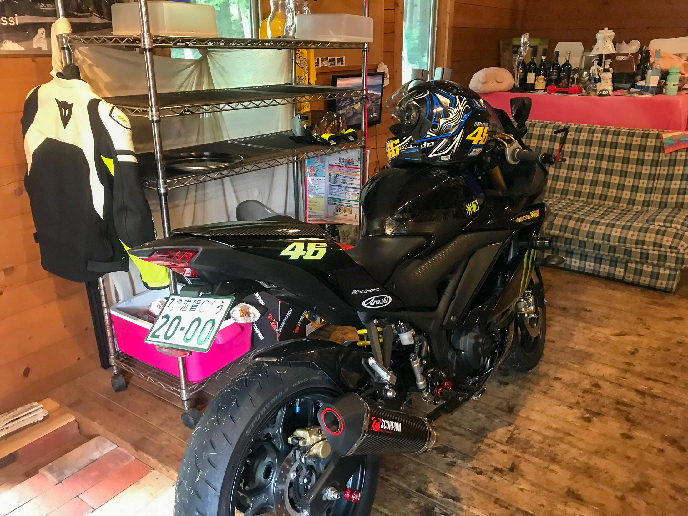
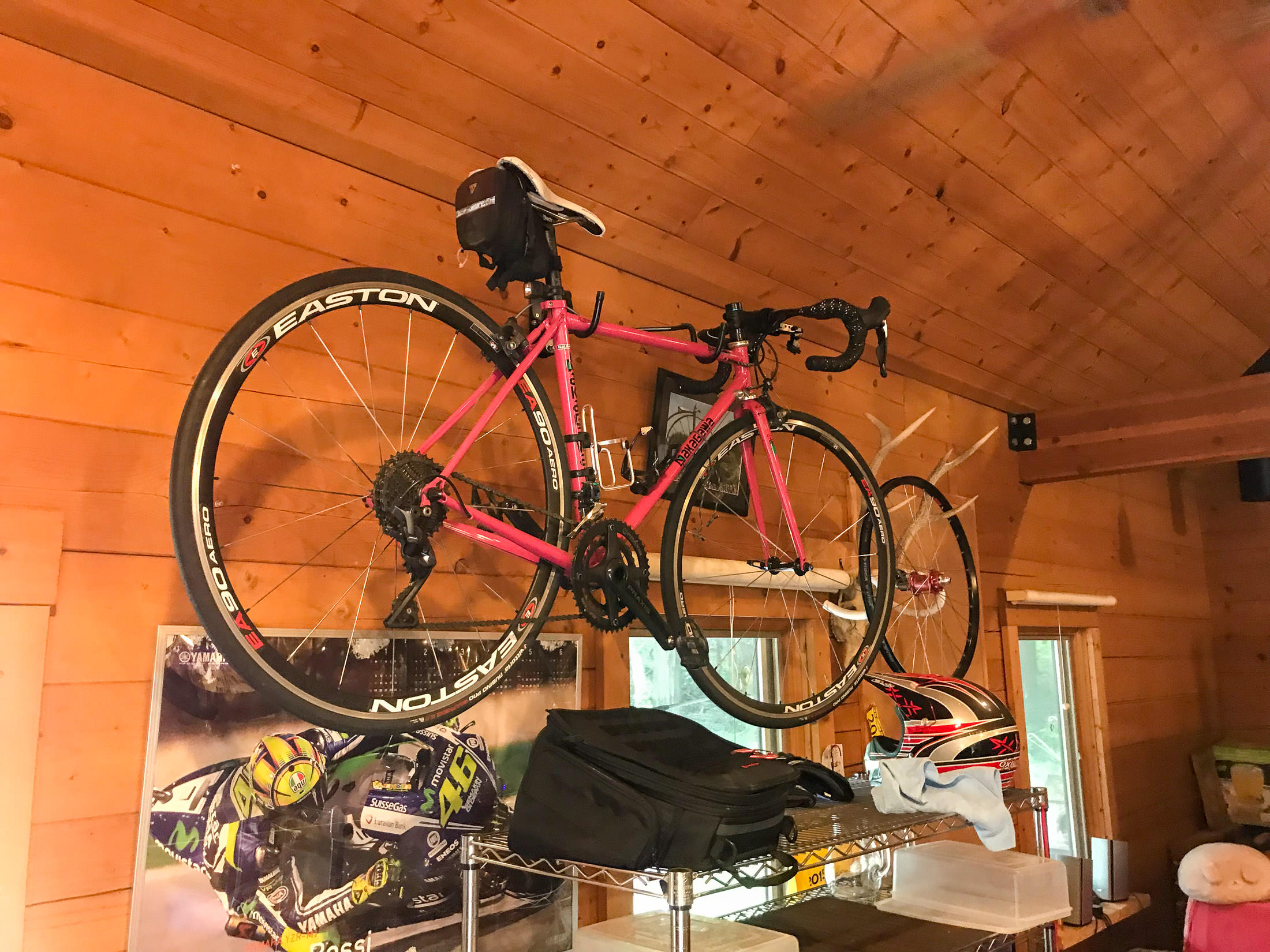
One of His Many Bicycles
iPhone 7 Plus f/1.8 at an effective 28mm — 1/15 sec, f/1.8, ISO 50 — map & image data — nearby photos
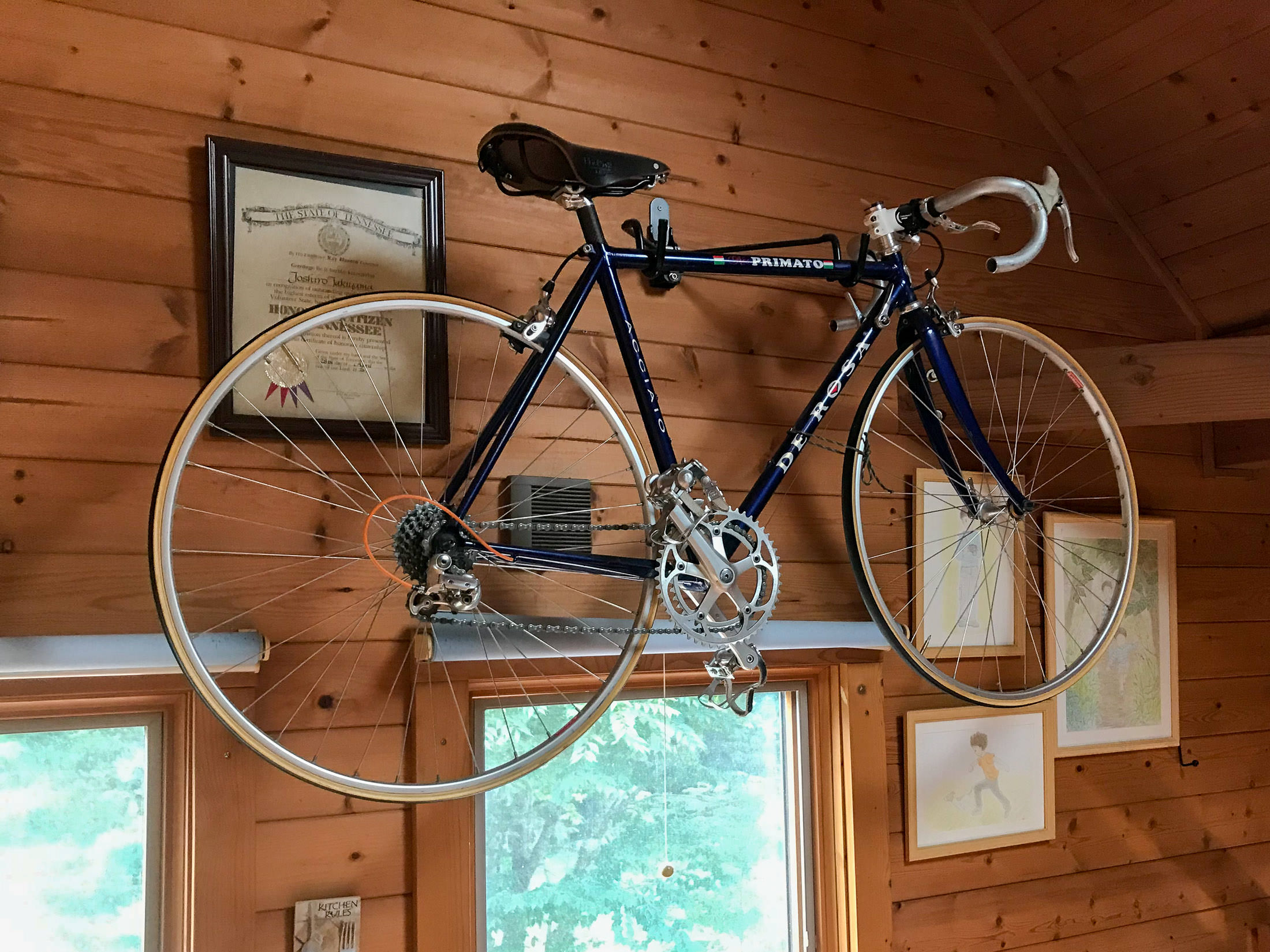
Another Bicycle Upstairs

iPhone 7 Plus f/1.8 at an effective 28mm — 1/4 sec, f/1.8, ISO 160 — map & image data — nearby photos
Dozens of Jerseys All Over
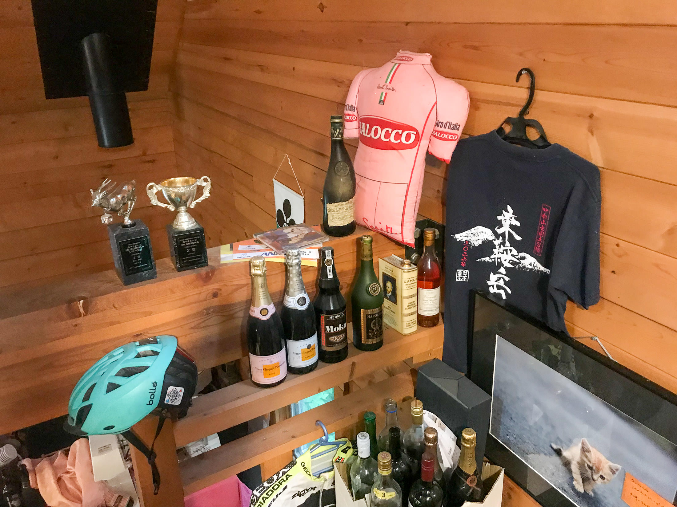
iPhone 7 Plus f/1.8 at an effective 28mm — 1/7 sec, f/1.8, ISO 80 — map & image data — nearby photos
Fun Vibe Everywhere
iPhone 7 Plus f/1.8 at an effective 28mm — 1/380 sec, f/1.8, ISO 20 — map & image data — nearby photos
Chillaxing
iPhone 7 Plus f/1.8 at an effective 28mm — 1/640 sec, f/1.8, ISO 20 — map & image data — nearby photos
Pizza!

iPhone 7 Plus f/1.8 at an effective 28mm — 1/1300 sec, f/1.8, ISO 20 — map & image data — nearby photos
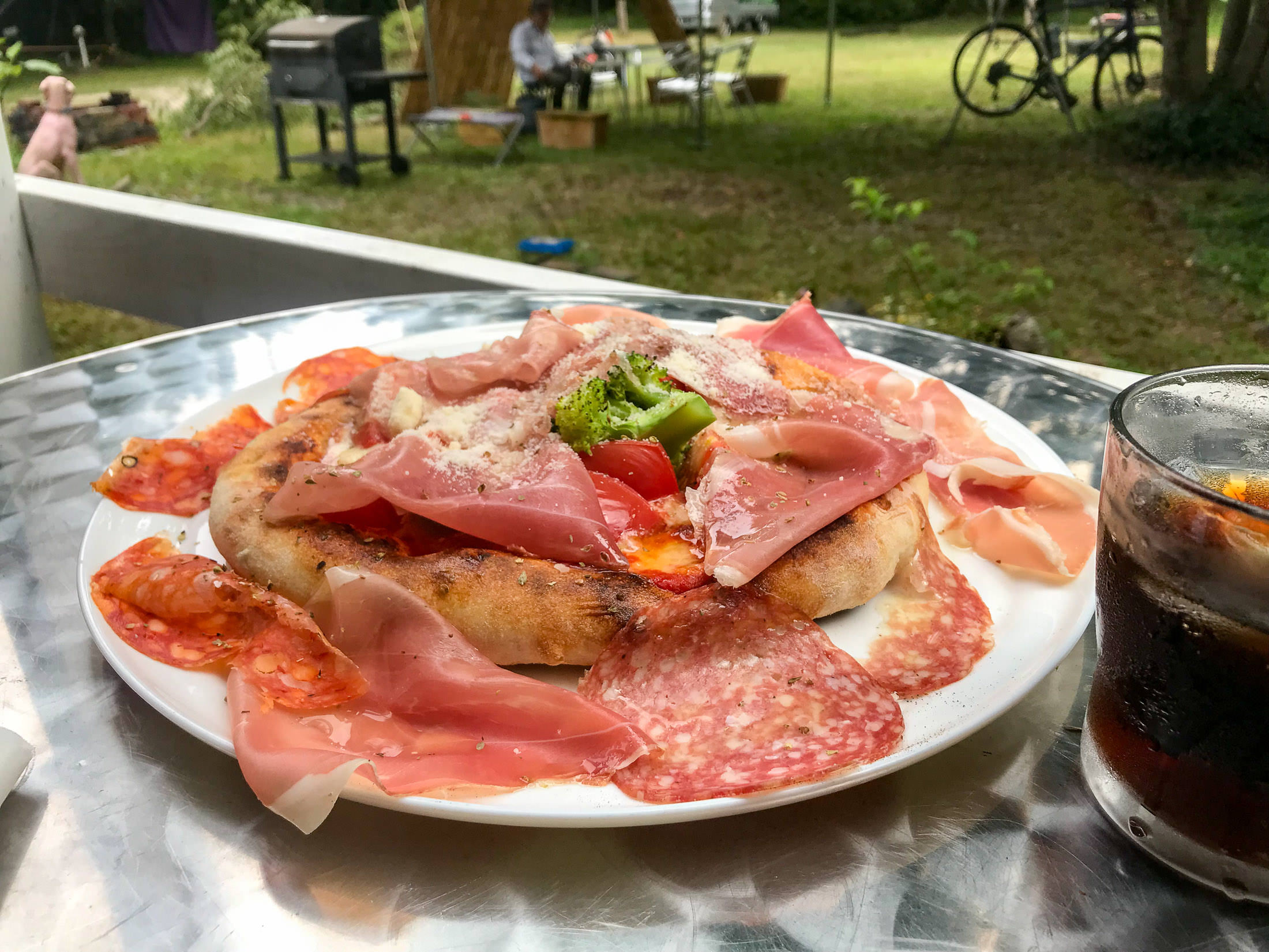
Much Bigger Than I Expected
with a lot of toppings

iPhone 7 Plus f/1.8 at an effective 28mm — 1/440 sec, f/1.8, ISO 20 — map & image data — nearby photos
I wasn't sure whether I could eat it all, but I took my time and dined as we chatted. It was delicious.
During our chat, I'd mentioned that I'd filled my water bottles with water from the shrine's spring, so he asked for a small amount, and used it to make me an espresso for me, on the house. Nice! Lots of cyclists visit after climbing to the spring, and its his policy that you get an espresso if you bring water from the spring.
As I eventually left, there was a lot of thunder rumbling in the distance, and a few scattered raindrops.
iPhone 7 Plus f/1.8 at an effective 28mm — 1/1100 sec, f/1.8, ISO 20 — map & image data — nearby photos
Doesn't Apply To Me
“Because of their slow speed, bicycles should be on the path”
(I was doing 35~40kph along this road)
15 minutes after leaving the pizza place, I realized that I had forgotten one of my water bottles, so I returned to get it. Then the rain really started, and it was lovely to ride in a warm rain. I only wish I could figure out a way to keep my sunglasses from fogging.
The rain continued until I got to within 15 minutes from home, and the weirdest thing happened. As I crossed this short bridge, the road and everything around it went from being completely soaked, to absolutely bone dry. It was the weirdest thing. There was no transition, other than the 15m long bridge. 100% wet to 100% dry. Weird.
It didn't stay dry long, because after about five minutes the lightning picked up, and the skies opened up in torrents. It was lovely.
Here's the ride on Strava:
A question! For all these small restaurants you visit, off the beaten path, that presumably don’t get a ton of business…how does one make enough money to survive? I always wonder about that sort of thing…
I often wonder, too. In this case, it sounds like the guy’s weekend business is very brisk with cyclists. —Jeffrey
Just WOW… 🙂 How was it going downhill?
Also pizza looks pretty good. Maybe I’ll hike up that road some day…
Wow! Those are some steep and steady hills! It sure is beautiful though, and inspiring to dust off the ol’ adventure bicycle.
The steepest sustained grade I’ve ever encountered was on the road to Rennell Sound in the Haida Gwaii – 18% over two kilometres…not fun when you’re fully loaded on a touring bike. Actually who am I kidding – it was crazy, but it WAS fun!
18% for 2km sounds like one might break a sweat, at least on a hot day. 😀 I don’t find the climbs fun, but I find having done them to be fun. 😉 —Jeffrey
Pizza from out of nowhere? it sounds like a treat and that look so good now i want one :D.
By the way, when i see your pictures cycling up into forests, i always wondering have you ever meet with bear or boar or any wild animals that chasing people? 😀
I see lots of wild animals, but as far as being chased by them, just the occasional dog or child. 😀 —Jeffrey
Love your rides especially when it’s up a hill!