Sort of Silly Cycling: Covering the Full Length National Routes 367 and 162 Just for the Sake of It
Off The Northern Coast Sea of Japan from Fukui Prefecture 日本海、福井県の若狭三方から -- Mikatakaminaka-gun -- Mikatakaminaka-gun, Fukui, Japan -- Copyright 2016 Jeffrey Friedl, http://regex.info/blog/ -- This photo is licensed to the public under the Creative Commons Attribution-NonCommercial 4.0 International License http://creativecommons.org/licenses/by-nc/4.0/ (non-commercial use is freely allowed if proper attribution is given, including a link back to this page on http://regex.info/ when used online)
Panasonic LX100 at an effective 24mm — 1/125 sec, f/5.6, ISO 200 — map & image datanearby photos
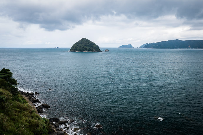
Off The Northern Coast
Sea of Japan from Fukui Prefecture
日本海、福井県の若狭三方から

先週なんとなく国道367号線国道162号線のゼンセンを乗るのは面白いかもと思いました。 普通はサイクリングすろと国道を抜きたいですが、今回ワザトこの国道全線を乗る。京都市内五条烏丸で始まる国道367号線乗って北へ。 そして、日本海の近くの福井県三方で始まる国道162号線で南へ。 結局225キロをゆったり走りました。京都市周辺以外には道は良かった。車は少なかった。

Last week I got it into my head to do a theme bicycle ride: ride the length of National Routes 367 and 162. The total of both is about 183km (114mi), but with the transition between and bits before and after, the ride (see at Strava) ended up being 225km (140mi).

Both routes have endpoints in Kyoto, and many fun rides include parts of them, but in most cases the national routes are used begrudgingly as a quick way to get to the fun part of the ride. The ride is fun despite the parts on the national route, which with traffic and tunnels, generally fall into the less fun category.

So, I thought it'd be something (what I'm not exactly sure) to face this head on and make them the point of the ride.

For reference, here they are on the map:
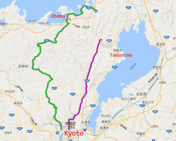
National Route 367 is in purple; it's about 57km (35mi) long. National Route 162 is in green; it's 127km (78mi) long (I live at the yellow star)
image data
National Route 367 is in purple; it's about 57km (35mi) long.
National Route 162 is in green; it's 127km (78mi) long
(I live at the yellow star)

I went to the base of the purple route and took it north, then continued to the top of the green route, by which I then returned to Kyoto.

Here's the view on Strava:
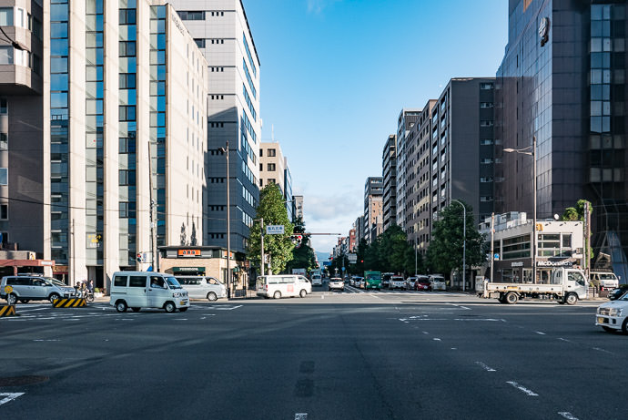
Start of National Route 167 Corner of Gojo and Karasuma Streets, downtown Kyoto Japan 7:36am -- Gojo Station -- Copyright 2016 Jeffrey Friedl, http://regex.info/blog/ -- This photo is licensed to the public under the Creative Commons Attribution-NonCommercial 4.0 International License http://creativecommons.org/licenses/by-nc/4.0/ (non-commercial use is freely allowed if proper attribution is given, including a link back to this page on http://regex.info/ when used online)
Panasonic LX100 at an effective 32mm — 1/320 sec, f/5.6, ISO 200 — map & image datanearby photos
Start of National Route 167
Corner of Gojo and Karasuma Streets, downtown Kyoto Japan
7:36am
First Turn Coming Up 7:53am - taken while cycling at 25 kph (15 mph) -- Kyoto, Japan -- Copyright 2016 Jeffrey Friedl, http://regex.info/blog/ -- This photo is licensed to the public under the Creative Commons Attribution-NonCommercial 4.0 International License http://creativecommons.org/licenses/by-nc/4.0/ (non-commercial use is freely allowed if proper attribution is given, including a link back to this page on http://regex.info/ when used online)
Panasonic LX100 at an effective 24mm — 1/125 sec, f/5, ISO 200 — map & image datanearby photos
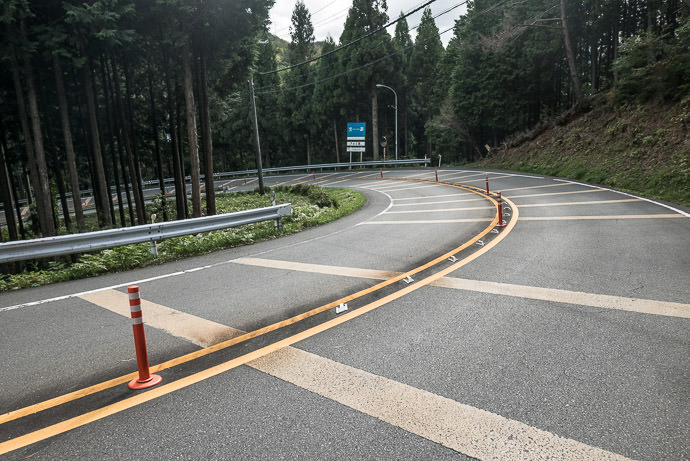
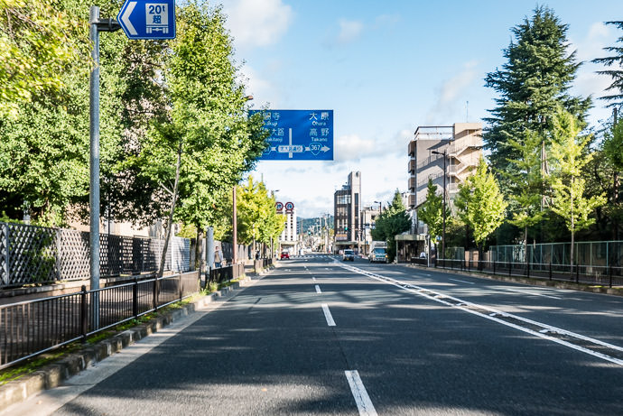
First Turn Coming Up
7:53am - taken while cycling at 25 kph (15 mph)

Within the city the idea of a National Route is merely notational, and it shifts streets a few times before it settles on the actual stretch of blacktop that heads north into the mountains. There are only three such turns on the entire length of road, and all are within the first little bit, but I managed to screw even that up and managed to get off course in the first 10 minutes. Sigh.

But, I quickly recovered and that was the last navigational mistake of the day, thank goodness.

Soon I was out of the city...
An Hour In 8:45am — typical scene -- Otsu, Shiga, Japan -- Copyright 2016 Jeffrey Friedl, http://regex.info/blog/ -- This photo is licensed to the public under the Creative Commons Attribution-NonCommercial 4.0 International License http://creativecommons.org/licenses/by-nc/4.0/ (non-commercial use is freely allowed if proper attribution is given, including a link back to this page on http://regex.info/ when used online)
Panasonic LX100 at an effective 24mm — 1/320 sec, f/4.5, ISO 200 — map & image datanearby photos
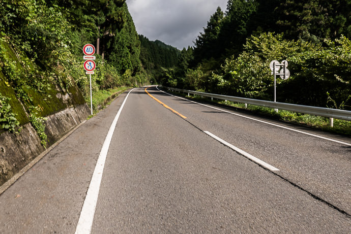
An Hour In
8:45am — typical scene
Monkeys! crop from a larger photo; taken while climbing a steep rise at 12 kph (8 mph) -- Otsu, Shiga, Japan -- Copyright 2016 Jeffrey Friedl, http://regex.info/blog/ -- This photo is licensed to the public under the Creative Commons Attribution-NonCommercial 4.0 International License http://creativecommons.org/licenses/by-nc/4.0/ (non-commercial use is freely allowed if proper attribution is given, including a link back to this page on http://regex.info/ when used online)
Panasonic LX100 at an effective 24mm — 1/125 sec, f/4.5, ISO 1250 — map & image datanearby photos
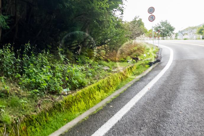
Monkeys!
crop from a larger photo; taken while climbing a steep rise at 12 kph (8 mph)
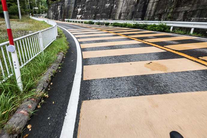
Steep Climb! this is much more fun to go down ( like this and this ) than to climb up -- Otsu, Shiga, Japan -- Copyright 2016 Jeffrey Friedl, http://regex.info/blog/ -- This photo is licensed to the public under the Creative Commons Attribution-NonCommercial 4.0 International License http://creativecommons.org/licenses/by-nc/4.0/ (non-commercial use is freely allowed if proper attribution is given, including a link back to this page on http://regex.info/ when used online)
Panasonic LX100 at an effective 24mm — 1/125 sec, f/4.5, ISO 250 — map & image datanearby photos
Steep Climb!
this is much more fun to go down (like this and this) than to climb up

The weather forecast for Kyoto had a 0% chance of rain, but upon exiting a long tunnel an hour and a half in, at the highest elevation I'd reach all day, I was reminded that I was no longer in Kyoto... it was cold, windy, and rainy.

It rained on and off for much of the day until I got back to Kyoto.
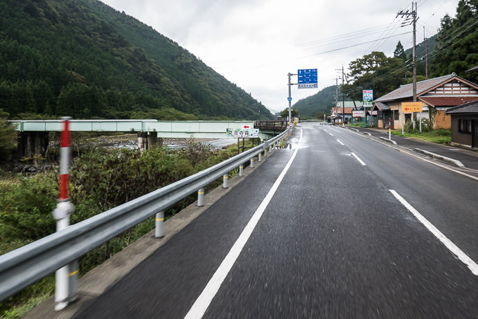
Passing The Turnoff To Kuta 9:12am - taken while cycling at 41 kph (26 mph) -- Otsu, Shiga, Japan -- Copyright 2016 Jeffrey Friedl, http://regex.info/blog/ -- This photo is licensed to the public under the Creative Commons Attribution-NonCommercial 4.0 International License http://creativecommons.org/licenses/by-nc/4.0/ (non-commercial use is freely allowed if proper attribution is given, including a link back to this page on http://regex.info/ when used online)
Panasonic LX100 at an effective 24mm — 1/125 sec, f/4.5, ISO 500 — map & image datanearby photos
Passing The Turnoff To Kuta
9:12am - taken while cycling at 41 kph (26 mph)

An hour and a half into Route 367 I came to the turnoff to the Kuta region. I'd just been here on the ride mentioned in the previous point, as the fork between fast and safe, where I'd opted away from the national route in the increasing darkness. No worries about that today.

Rough calculations told me that I'd make it home by daylight if I could maintain a 20kph pace (12½mph), including all stops. (I left at about 7:30am; sunset was about 5:30pm).

That's an easy pace to maintain on all but the few steepest sections of these big modern roads, but the devil is in the including all stops detail. It's amazing how much time you can lose pausing for traffic lights, traffic, taking photos, buying a drink, eating, or just to catch your breath, much less to mechanical issues like flat tires. So it was comforting to compare the hours ticking off the clock, to the kilometers ticking up on the readout, and realize that I was keeping comfortably within range.

(My cycling computer, a Garmin 820, has a virtual partner feature where it can ostensibly tell you how far ahead or behind a certain pace you are, but it was ridiculously incorrect — 2 minutes behind instead of 35 minutes ahead, for example. Perhaps somehow its functionality changes if you're navigating a route? Sigh, I may have to actually hunt down the manual.)
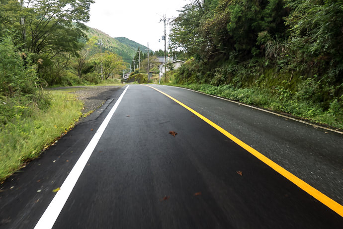
Wet and Rainy but little traffic this far north, 44km (28mi) into Route 367 9:23am - taken while cycling at 18 kph (11 mph) -- Takashima, Shiga, Japan -- Copyright 2016 Jeffrey Friedl, http://regex.info/blog/ -- This photo is licensed to the public under the Creative Commons Attribution-NonCommercial 4.0 International License http://creativecommons.org/licenses/by-nc/4.0/ (non-commercial use is freely allowed if proper attribution is given, including a link back to this page on http://regex.info/ when used online)
Panasonic LX100 at an effective 24mm — 1/125 sec, f/4.5, ISO 1000 — map & image datanearby photos
Wet and Rainy
but little traffic this far north, 44km (28mi) into Route 367
9:23am - taken while cycling at 18 kph (11 mph)
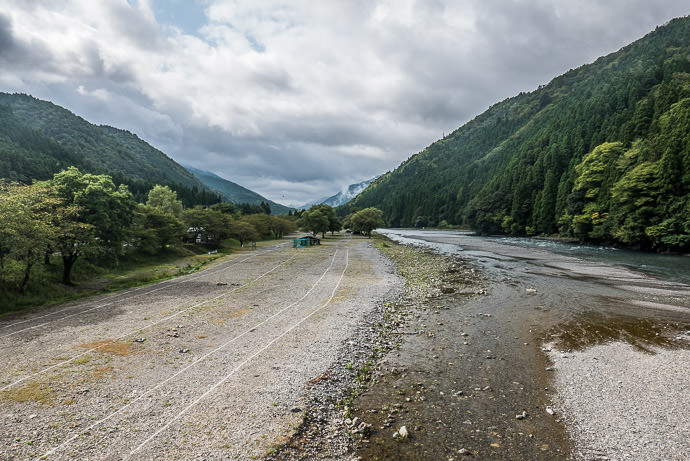
Crossing a River over a riverside campground -- 桑野橋 -- Takashima, Shiga, Japan -- Copyright 2016 Jeffrey Friedl, http://regex.info/blog/ -- This photo is licensed to the public under the Creative Commons Attribution-NonCommercial 4.0 International License http://creativecommons.org/licenses/by-nc/4.0/ (non-commercial use is freely allowed if proper attribution is given, including a link back to this page on http://regex.info/ when used online)
Panasonic LX100 at an effective 24mm — 1/320 sec, f/5.6, ISO 200 — map & image datanearby photos
Crossing a River
over a riverside campground
Kutsuki Village near the turnoff to the ski grounds mentioned in the previous post 9:37am - taken while cycling at 13 kph (8 mph) -- おみやげのカネハチ -- Takashima, Shiga, Japan -- Copyright 2016 Jeffrey Friedl, http://regex.info/blog/ -- This photo is licensed to the public under the Creative Commons Attribution-NonCommercial 4.0 International License http://creativecommons.org/licenses/by-nc/4.0/ (non-commercial use is freely allowed if proper attribution is given, including a link back to this page on http://regex.info/ when used online)
Panasonic LX100 at an effective 24mm — 1/640 sec, f/4.5, ISO 200 — map & image datanearby photos
Kutsuki Village
near the turnoff to the ski grounds mentioned in the previous post
9:37am - taken while cycling at 13 kph (8 mph)

I'd never been farther north than this village, so I was happy to see new road. I was greeted with a 130m (430') climb, then a descent toward the end of the road...
The End of National Route 367 9:57am — 2:20 and 57km (35mi) from the start -- Takashima, Shiga, Japan -- Copyright 2016 Jeffrey Friedl, http://regex.info/blog/ -- This photo is licensed to the public under the Creative Commons Attribution-NonCommercial 4.0 International License http://creativecommons.org/licenses/by-nc/4.0/ (non-commercial use is freely allowed if proper attribution is given, including a link back to this page on http://regex.info/ when used online)
Panasonic LX100 at an effective 44mm — 1/125 sec, f/2.6, ISO 200 — map & image datanearby photos
The End of National Route 367
9:57am — 2:20 and 57km (35mi) from the start

After finishing National Route 367, I had to continue away from Kyoto another hour's ride farther north toward the start of National Route 162, and as I started that leg, I made a shocking discovery: the gear shifters on my bike was almost out of battery!

My bike has Shimano Di2 electric derailleurs, powered by a battery that I have to charge a few times a year. The previous night I'd checked and found it had 29% battery left, enough to last a month. At the start this morning, though, the readout said 20%, so I started to worry that the readout wasn't trustworthy, but it remained at 20% halfway up Route 367, so my mind was put at ease. But now, at the end of Route 367, I was shocked to see it at 10%! If I were to run out of battery, I'd be stuck in whatever gear the bike was in for the rest of the ride.

To save on battery I removed the wireless-communication module (which communicated the untrustworthy battery level to my cycling computer), and tried to avoid shifting as much as possible. In one sense it created a perhaps useful kind of training as I stuck with a single gear through a much wider range of cadence/power than I would naturally do.

With some trepidation I made my way north on Route 303, filled with trucks and blistering cross winds. I'd ridden in strong winds before (e.g. this ride to Osaka), but never at high speed. I guess in this case I was lucky for the trucks, because traffic was moving at the posted 50kph speed limit, so I found some shelter in the lee behind a truck and could avoid some of the stronger gusts.
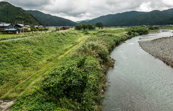
Typical Scene 10:24am - taken while cycling at 17 kph (11 mph) -- Mikatakaminaka-gun -- Mikatakaminaka-gun, Fukui, Japan -- Copyright 2016 Jeffrey Friedl, http://regex.info/blog/ -- This photo is licensed to the public under the Creative Commons Attribution-NonCommercial 4.0 International License http://creativecommons.org/licenses/by-nc/4.0/ (non-commercial use is freely allowed if proper attribution is given, including a link back to this page on http://regex.info/ when used online)
Panasonic LX100 at an effective 24mm — 1/500 sec, f/5.6, ISO 200 — map & image datanearby photos
Typical Scene
10:24am - taken while cycling at 17 kph (11 mph)
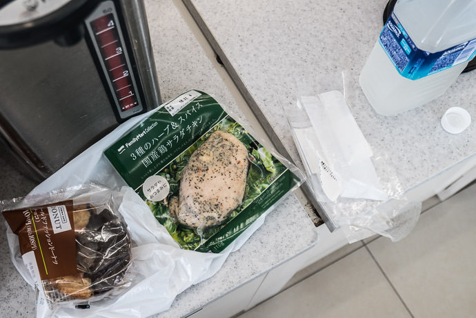
Lunch at a convenience store, 3½ hours in chicken breast, rice ball (already eaten), and a doughnut -- Mikatakaminaka-gun -- Mikatakaminaka-gun, Fukui, Japan -- Copyright 2016 Jeffrey Friedl, http://regex.info/blog/ -- This photo is licensed to the public under the Creative Commons Attribution-NonCommercial 4.0 International License http://creativecommons.org/licenses/by-nc/4.0/ (non-commercial use is freely allowed if proper attribution is given, including a link back to this page on http://regex.info/ when used online)
Panasonic LX100 at an effective 32mm — 1/125 sec, f/2.2, ISO 250 — map & image datanearby photos
Lunch
at a convenience store, 3½ hours in
chicken breast, rice ball (already eaten), and a doughnut
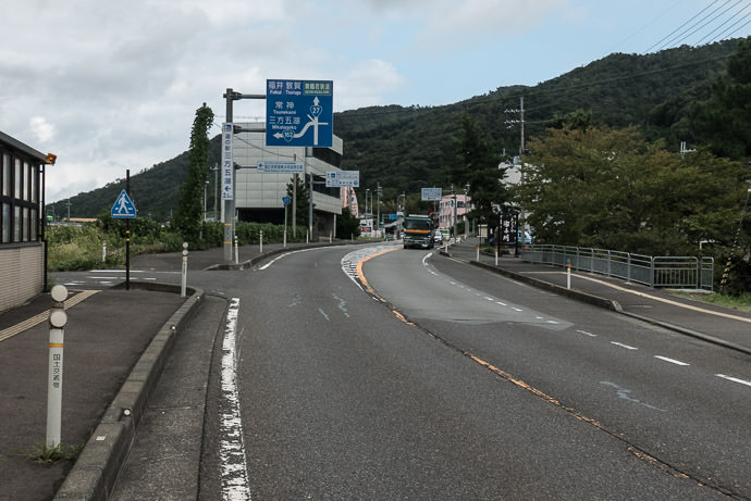
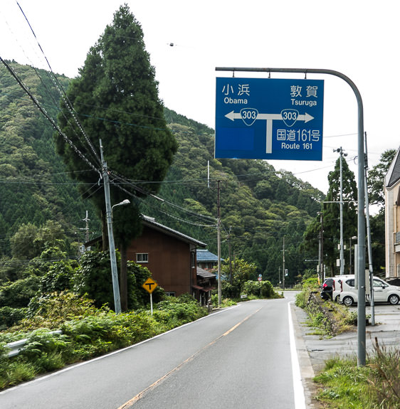
Approaching National Route 162 11:13am - it begins at the next left -- Mikatakaminaka-gun -- Mikatakaminaka-gun, Fukui, Japan -- Copyright 2016 Jeffrey Friedl, http://regex.info/blog/ -- This photo is licensed to the public under the Creative Commons Attribution-NonCommercial 4.0 International License http://creativecommons.org/licenses/by-nc/4.0/ (non-commercial use is freely allowed if proper attribution is given, including a link back to this page on http://regex.info/ when used online)
Panasonic LX100 at an effective 24mm — 1/320 sec, f/5.6, ISO 200 — map & image datanearby photos
Approaching National Route 162
11:13am - it begins at the next left
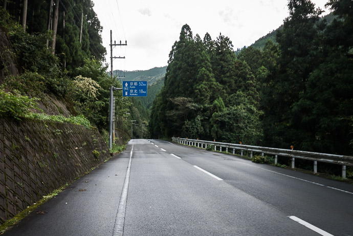
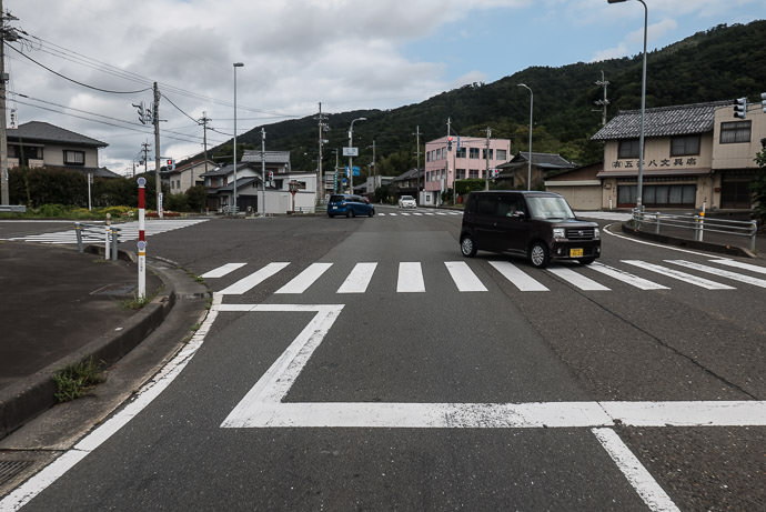
Anonymous-Looking Intersection Kyoto is to the left, 125km (78) miles away -- Mikatakaminaka-gun -- Mikatakaminaka-gun, Fukui, Japan -- Copyright 2016 Jeffrey Friedl, http://regex.info/blog/ -- This photo is licensed to the public under the Creative Commons Attribution-NonCommercial 4.0 International License http://creativecommons.org/licenses/by-nc/4.0/ (non-commercial use is freely allowed if proper attribution is given, including a link back to this page on http://regex.info/ when used online)
Panasonic LX100 at an effective 24mm — 1/320 sec, f/5.6, ISO 200 — map & image datanearby photos
Anonymous-Looking Intersection
Kyoto is to the left, 125km (78) miles away

The first few hundred meters of National Route 162 is a flyover bridge above some railroad tracks, and officially bicycles are not allowed on that short stretch. No one was around so I took it, and can't understand why bicycles would be prohibited... it would have been perfectly safe even in heavy traffic. It took 30 seconds to transverse.

15 minutes of pleasant cycling later, I arrived at the first tunnel of National Route 162:
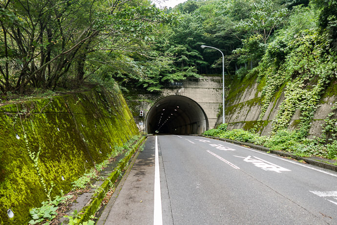
National Route 162 Tunnel #1 -- Mikatakaminaka-gun -- Mikatakaminaka-gun, Fukui, Japan -- Copyright 2016 Jeffrey Friedl, http://regex.info/blog/ -- This photo is licensed to the public under the Creative Commons Attribution-NonCommercial 4.0 International License http://creativecommons.org/licenses/by-nc/4.0/ (non-commercial use is freely allowed if proper attribution is given, including a link back to this page on http://regex.info/ when used online)
Panasonic LX100 at an effective 24mm — 1/125 sec, f/2.2, ISO 200 — map & image datanearby photos
National Route 162 Tunnel #1

Tunnels with traffic can be particularly dangerous for bicycles, so we're generally aware of them and their condition when planning a route, and try to avoid them when conditions warrant. But with today's theme ride, I'd take all tunnels however they came.

And they came. National Route 367 has six tunnels over its length. They tend to be safer when riding south-to-north because the slope lets you ride with traffic, which is why I did today's loop in this counter-clockwise direction.

The roads I took to move to the start of National Route 162 included two tunnels.

National Route 162, though, has 18(!) tunnels over its length.

Passing through this first tunnel, I emerged to find the Sea of Japan:
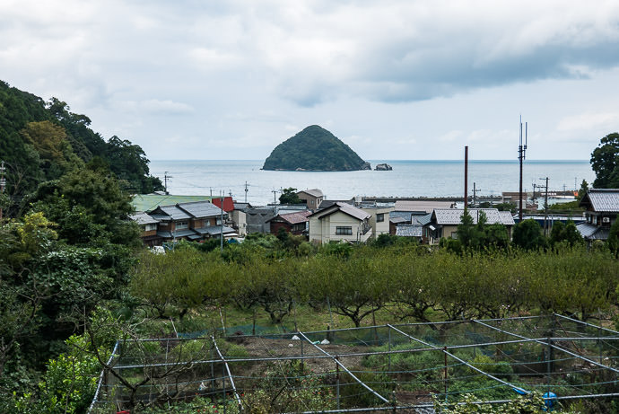
First View of the Ocean 11:33am - four hours in -- Mikatakaminaka-gun -- Mikatakaminaka-gun, Fukui, Japan -- Copyright 2016 Jeffrey Friedl, http://regex.info/blog/ -- This photo is licensed to the public under the Creative Commons Attribution-NonCommercial 4.0 International License http://creativecommons.org/licenses/by-nc/4.0/ (non-commercial use is freely allowed if proper attribution is given, including a link back to this page on http://regex.info/ when used online)
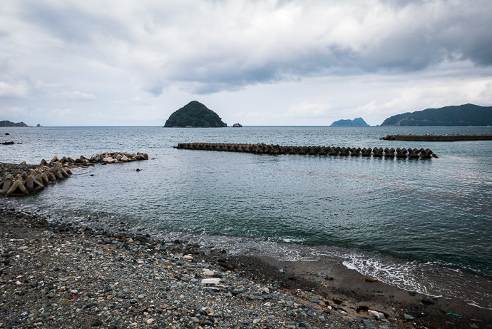
Panasonic LX100 at an effective 43mm — 1/160 sec, f/5.6, ISO 200 — map & image datanearby photos
First View of the Ocean
11:33am - four hours in
A Minute Later from sea level -- Mikatakaminaka-gun -- Mikatakaminaka-gun, Fukui, Japan -- Copyright 2016 Jeffrey Friedl, http://regex.info/blog/ -- This photo is licensed to the public under the Creative Commons Attribution-NonCommercial 4.0 International License http://creativecommons.org/licenses/by-nc/4.0/ (non-commercial use is freely allowed if proper attribution is given, including a link back to this page on http://regex.info/ when used online)
Panasonic LX100 at an effective 24mm — 1/160 sec, f/5.6, ISO 200 — map & image datanearby photos
A Minute Later
from sea level

The road hugs the coast for a while, but rises and falls sharply. During one of the rises, I took the photo that leads this post.
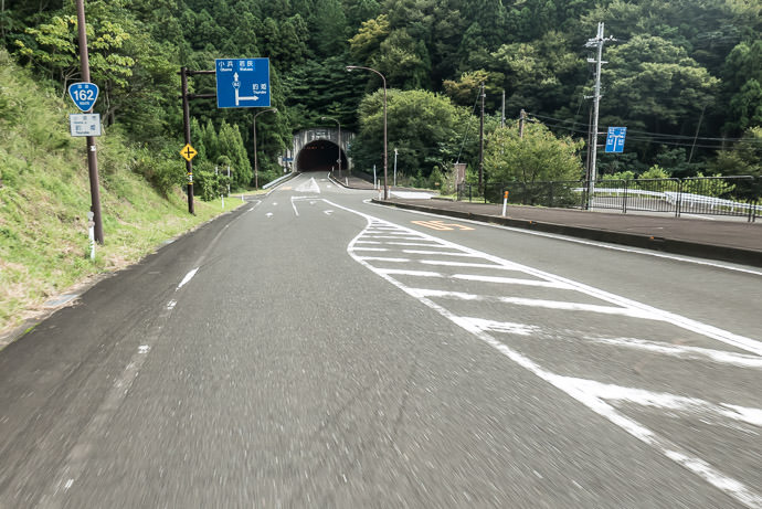
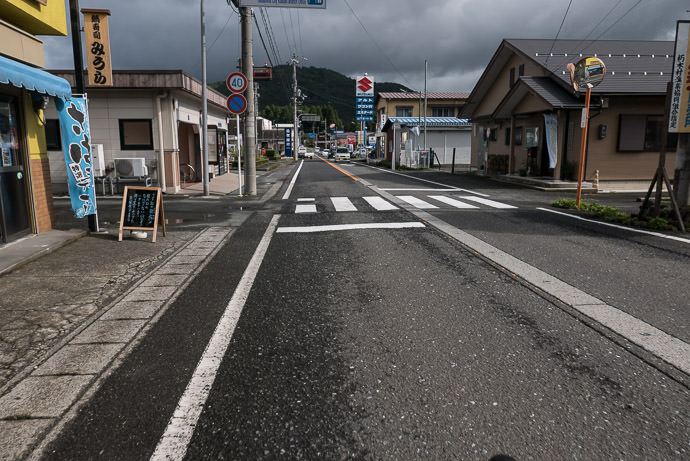
Typical Scene 11:47am - taken while cycling at 40 kph (25 mph) -- Obama, Fukui, Japan -- Copyright 2016 Jeffrey Friedl, http://regex.info/blog/ -- This photo is licensed to the public under the Creative Commons Attribution-NonCommercial 4.0 International License http://creativecommons.org/licenses/by-nc/4.0/ (non-commercial use is freely allowed if proper attribution is given, including a link back to this page on http://regex.info/ when used online)
Panasonic LX100 at an effective 24mm — 1/125 sec, f/5.6, ISO 640 — map & image datanearby photos
Typical Scene
11:47am - taken while cycling at 40 kph (25 mph)
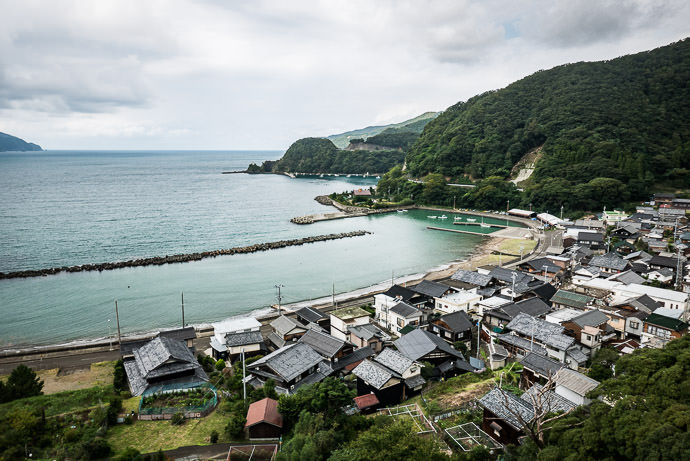
Typical Village nestled in a cove -- Obama, Fukui, Japan -- Copyright 2016 Jeffrey Friedl, http://regex.info/blog/ -- This photo is licensed to the public under the Creative Commons Attribution-NonCommercial 4.0 International License http://creativecommons.org/licenses/by-nc/4.0/ (non-commercial use is freely allowed if proper attribution is given, including a link back to this page on http://regex.info/ when used online)
Panasonic LX100 at an effective 24mm — 1/160 sec, f/5.6, ISO 200 — map & image datanearby photos
Typical Village
nestled in a cove
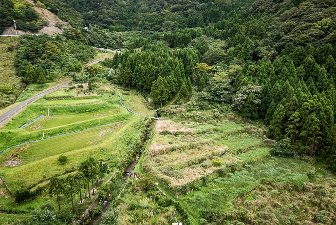
Valley View from a Bridge of rice fields both abandoned and in use -- Obama, Fukui, Japan -- Copyright 2016 Jeffrey Friedl, http://regex.info/blog/ -- This photo is licensed to the public under the Creative Commons Attribution-NonCommercial 4.0 International License http://creativecommons.org/licenses/by-nc/4.0/ (non-commercial use is freely allowed if proper attribution is given, including a link back to this page on http://regex.info/ when used online)
Panasonic LX100 at an effective 24mm — 1/125 sec, f/4.5, ISO 200 — map & image datanearby photos
Valley View from a Bridge
of rice fields both abandoned and in use
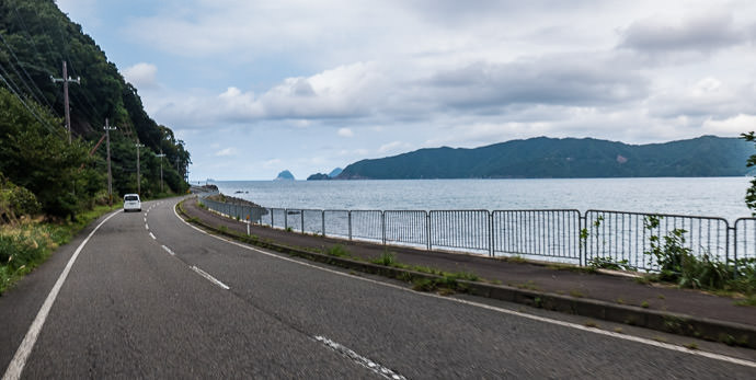
Hugging the Coast 12:03pm - taken while cycling at 40 kph (25 mph) -- Obama, Fukui, Japan -- Copyright 2016 Jeffrey Friedl, http://regex.info/blog/ -- This photo is licensed to the public under the Creative Commons Attribution-NonCommercial 4.0 International License http://creativecommons.org/licenses/by-nc/4.0/ (non-commercial use is freely allowed if proper attribution is given, including a link back to this page on http://regex.info/ when used online)
Panasonic LX100 at an effective 24mm — 1/200 sec, f/5, ISO 200 — map & image datanearby photos
Hugging the Coast
12:03pm - taken while cycling at 40 kph (25 mph)
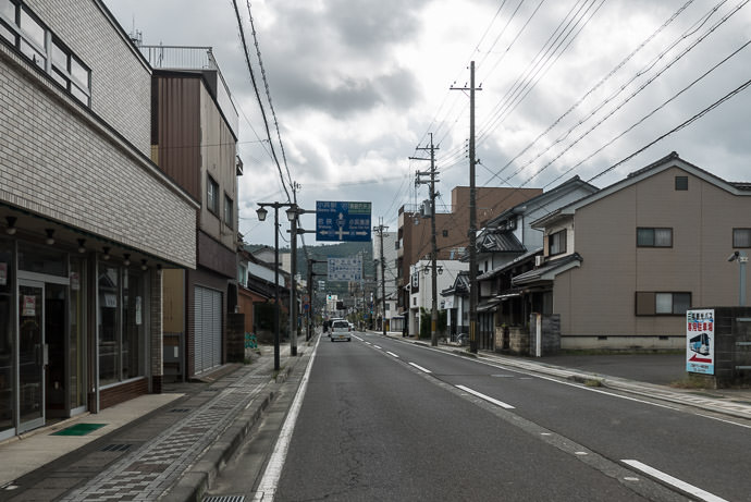
Descending into Obama City 12:28pm - taken while cycling at 28 kph (17 mph) -- Obama, Fukui, Japan -- Copyright 2016 Jeffrey Friedl, http://regex.info/blog/ -- This photo is licensed to the public under the Creative Commons Attribution-NonCommercial 4.0 International License http://creativecommons.org/licenses/by-nc/4.0/ (non-commercial use is freely allowed if proper attribution is given, including a link back to this page on http://regex.info/ when used online)
Panasonic LX100 at an effective 24mm — 1/320 sec, f/5.6, ISO 200 — map & image datanearby photos
Descending into Obama City
12:28pm - taken while cycling at 28 kph (17 mph)

I wanted to stop by The Mermaid to replicate this photo, but National Route 162 doesn't pass by (it's a block or two over), so I'd have to leave it for another day.
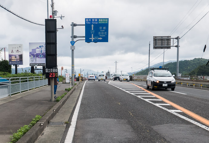
Right Turn South, Toward Kyoto 12:33pm - taken while cycling at 23 kph (14 mph) -- Obama, Fukui, Japan -- Copyright 2016 Jeffrey Friedl, http://regex.info/blog/ -- This photo is licensed to the public under the Creative Commons Attribution-NonCommercial 4.0 International License http://creativecommons.org/licenses/by-nc/4.0/ (non-commercial use is freely allowed if proper attribution is given, including a link back to this page on http://regex.info/ when used online)
Panasonic LX100 at an effective 24mm — 1/160 sec, f/5.6, ISO 200 — map & image datanearby photos
Right Turn South, Toward Kyoto
12:33pm - taken while cycling at 23 kph (14 mph)

The sign in the photo above had the first mention of Kyoto I'd noticed.

In the photo above, on the left side of the road, there's a temperature readout (23℃, about 74℉). Just behind it, a man dressed in blue is standing... sort of hiding.
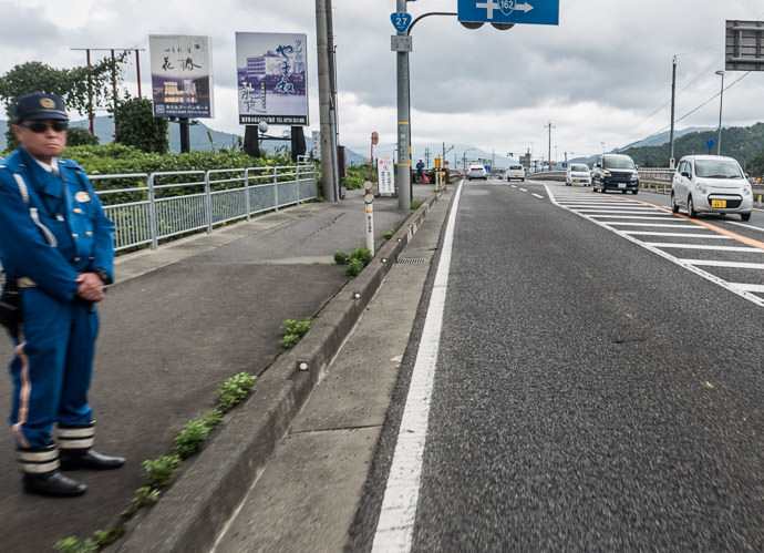
Hello 12:33pm - taken while cycling at 23 kph (14 mph) -- Obama, Fukui, Japan -- Copyright 2016 Jeffrey Friedl, http://regex.info/blog/ -- This photo is licensed to the public under the Creative Commons Attribution-NonCommercial 4.0 International License http://creativecommons.org/licenses/by-nc/4.0/ (non-commercial use is freely allowed if proper attribution is given, including a link back to this page on http://regex.info/ when used online)
Panasonic LX100 at an effective 24mm — 1/125 sec, f/5.6, ISO 200 — map & image datanearby photos
Hello
12:33pm - taken while cycling at 23 kph (14 mph)

In the far background is another policeman with a red STOP! flag, who will run out into traffic to stop someone the first policeman identifies as breaking some law. I most commonly see them standing like this near intersections looking for folks who make illegal turns (seemingly ignoring the plethora of folks who brazenly run red lights in the most staggeringly-obvious way), but in this case the first policeman was standing without a good view of an intersection, so I'm guessing he's on the watch for those not wearing seat belts.

I wasn't wearing a seat belt, but somehow skated by safely. 🙂
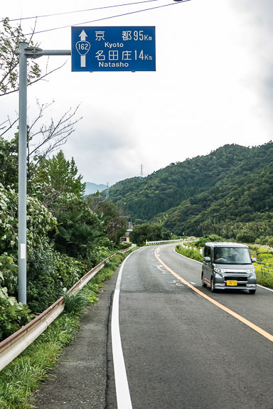
First Distance-to-Kyoto Sign 12:34pm - about five hours and 113km (70mi) in -- Obama, Fukui, Japan -- Copyright 2016 Jeffrey Friedl, http://regex.info/blog/ -- This photo is licensed to the public under the Creative Commons Attribution-NonCommercial 4.0 International License http://creativecommons.org/licenses/by-nc/4.0/ (non-commercial use is freely allowed if proper attribution is given, including a link back to this page on http://regex.info/ when used online)
Panasonic LX100 at an effective 44mm — 1/125 sec, f/4, ISO 200 — map & image datanearby photos
First Distance-to-Kyoto Sign
12:34pm - about five hours and 113km (70mi) in

Not long after this, my front derailleur stopped working, an indication that the battery had reached a critically-low level. By design, the front derailleur stops working first. Eventually, the rear derailleur will stop as well. I still had 80 or 90 kilometers left to get home, and I wasn't in the mood to ride it on a fixie (a bicycle without the ability to change gears), so I went into ultra-conservative mode, changing gears only at the top or bottom of big climbs.... maybe once every 10 or 20 kilometers.
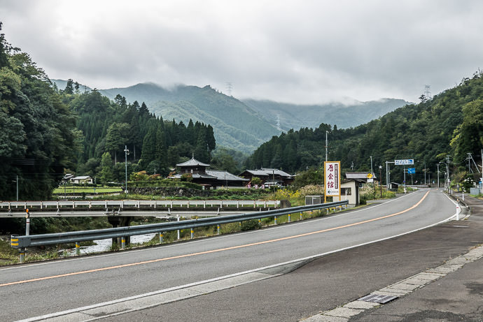
Rest Break 1:47pm - as an imminent rain starts to gather -- Ōi-gun -- Oi-gun, Fukui, Japan -- Copyright 2016 Jeffrey Friedl, http://regex.info/blog/ -- This photo is licensed to the public under the Creative Commons Attribution-NonCommercial 4.0 International License http://creativecommons.org/licenses/by-nc/4.0/ (non-commercial use is freely allowed if proper attribution is given, including a link back to this page on http://regex.info/ when used online)
Panasonic LX100 at an effective 38mm — 1/125 sec, f/4.5, ISO 200 — map & image datanearby photos
Rest Break
1:47pm - as an imminent rain starts to gather
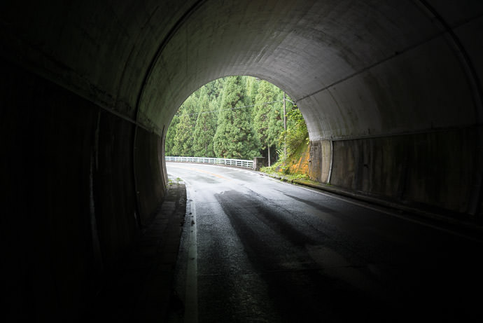
Respite from the Rain 2:05pm - about half way into the tunnel count for National Route 162 -- Ōi-gun -- Oi-gun, Fukui, Japan -- Copyright 2016 Jeffrey Friedl, http://regex.info/blog/ -- This photo is licensed to the public under the Creative Commons Attribution-NonCommercial 4.0 International License http://creativecommons.org/licenses/by-nc/4.0/ (non-commercial use is freely allowed if proper attribution is given, including a link back to this page on http://regex.info/ when used online)
Panasonic LX100 at an effective 24mm — 1/60 sec, f/1.7, ISO 320 — map & image datanearby photos
Respite from the Rain
2:05pm - about half way into the tunnel count for National Route 162

Not long after this came the most-wonderful Miyama Morisato Descent, a lovely descent on gently curving very-well-paved no-traffic road, so it was painful to be stuck in the small chainring... I'd spin out at about 45kph. I still managed a PR (personal record) on it because the one other time I'd done it was with Gorm, where descents are social.

Next time.
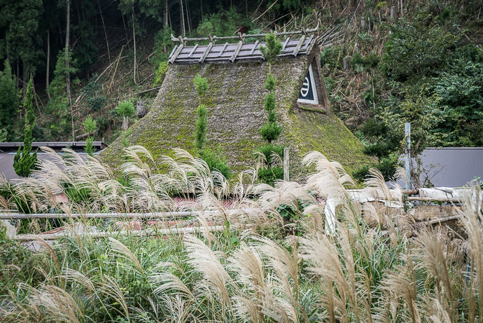
House -- Nantan, Kyoto, Japan -- Copyright 2016 Jeffrey Friedl, http://regex.info/blog/ -- This photo is licensed to the public under the Creative Commons Attribution-NonCommercial 4.0 International License http://creativecommons.org/licenses/by-nc/4.0/ (non-commercial use is freely allowed if proper attribution is given, including a link back to this page on http://regex.info/ when used online)
Panasonic LX100 at an effective 60mm — 1/125 sec, f/3.5, ISO 200 — map & image datanearby photos
House
Looking Back on a steep climb made without shifting... I don't know how fixie folks do it ( despite stopping for photos, I still made a PR , which surprised me ) -- Nantan, Kyoto, Japan -- Copyright 2016 Jeffrey Friedl, http://regex.info/blog/ -- This photo is licensed to the public under the Creative Commons Attribution-NonCommercial 4.0 International License http://creativecommons.org/licenses/by-nc/4.0/ (non-commercial use is freely allowed if proper attribution is given, including a link back to this page on http://regex.info/ when used online)
Panasonic LX100 at an effective 24mm — 1/125 sec, f/5, ISO 200 — map & image datanearby photos
Looking Back
on a steep climb made without shifting... I don't know how fixie folks do it
( despite stopping for photos, I still made a PR (new personal record), which surprised me )
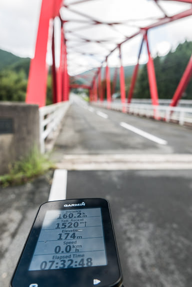
About the Century Mark in Miyama where I'd passed on a ride last week -- Nantan, Kyoto, Japan -- Copyright 2016 Jeffrey Friedl, http://regex.info/blog/ -- This photo is licensed to the public under the Creative Commons Attribution-NonCommercial 4.0 International License http://creativecommons.org/licenses/by-nc/4.0/ (non-commercial use is freely allowed if proper attribution is given, including a link back to this page on http://regex.info/ when used online)
Panasonic LX100 at an effective 26mm — 1/125 sec, f/4.5, ISO 200 — map & image datanearby photos
About the Century Mark
in Miyama where I'd passed on a ride last week
(a century in cycling is a 100-mile (160.9km) ride)
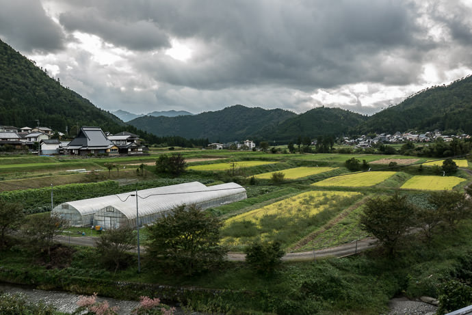
Farmland -- Nantan, Kyoto, Japan -- Copyright 2016 Jeffrey Friedl, http://regex.info/blog/ -- This photo is licensed to the public under the Creative Commons Attribution-NonCommercial 4.0 International License http://creativecommons.org/licenses/by-nc/4.0/ (non-commercial use is freely allowed if proper attribution is given, including a link back to this page on http://regex.info/ when used online)
Panasonic LX100 at an effective 34mm — 1/125 sec, f/5, ISO 200 — map & image datanearby photos
Farmland
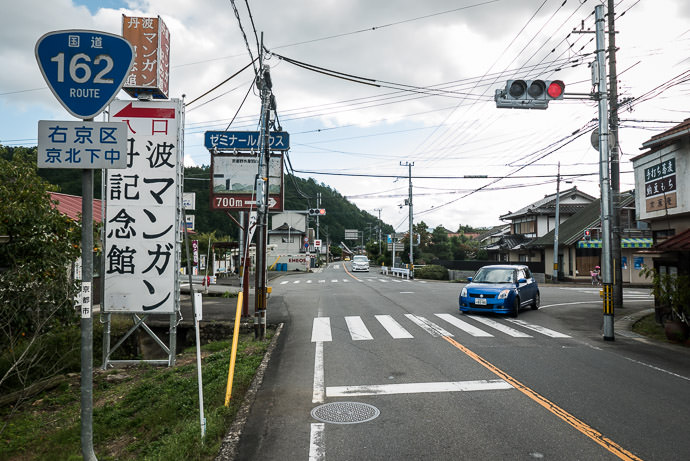
Long Climb only 52km (32mi) to go 2:59pm - taken while cycling at 22 kph (14 mph) -- Nantan, Kyoto, Japan -- Copyright 2016 Jeffrey Friedl, http://regex.info/blog/ -- This photo is licensed to the public under the Creative Commons Attribution-NonCommercial 4.0 International License http://creativecommons.org/licenses/by-nc/4.0/ (non-commercial use is freely allowed if proper attribution is given, including a link back to this page on http://regex.info/ when used online)
Panasonic LX100 at an effective 24mm — 1/125 sec, f/3.5, ISO 200 — map & image datanearby photos
Long Climb
only 52km (32mi) to go
2:59pm - taken while cycling at 22 kph (14 mph)
Bigger Village 3:33pm -- Kyoto, Japan -- Copyright 2016 Jeffrey Friedl, http://regex.info/blog/ -- This photo is licensed to the public under the Creative Commons Attribution-NonCommercial 4.0 International License http://creativecommons.org/licenses/by-nc/4.0/ (non-commercial use is freely allowed if proper attribution is given, including a link back to this page on http://regex.info/ when used online)
Panasonic LX100 at an effective 24mm — 1/125 sec, f/4.5, ISO 200 — map & image datanearby photos
Bigger Village
3:33pm

By now I was far enough south to be out of the rain for the rest of the trip.
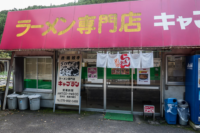
Ramen Shop ラーメン 専門店 キャプテン -- ラーメン専門店キャプテン -- Kyoto, Japan -- Copyright 2016 Jeffrey Friedl, http://regex.info/blog/ -- This photo is licensed to the public under the Creative Commons Attribution-NonCommercial 4.0 International License http://creativecommons.org/licenses/by-nc/4.0/ (non-commercial use is freely allowed if proper attribution is given, including a link back to this page on http://regex.info/ when used online)
Panasonic LX100 at an effective 24mm — 1/125 sec, f/1.7, ISO 200 — map & image datanearby photos
Ramen Shop
ラーメン専門店キャプテン

My derailleur aside, things were going great, so I stopped into a ramen place near the Kasa Tunnel, for wild-boar raman...
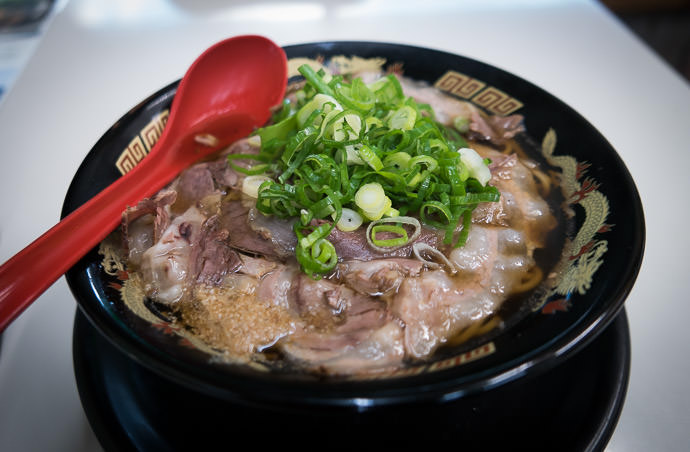
Yum -- ラーメン専門店キャプテン -- Kyoto, Japan -- Copyright 2016 Jeffrey Friedl, http://regex.info/blog/ -- This photo is licensed to the public under the Creative Commons Attribution-NonCommercial 4.0 International License http://creativecommons.org/licenses/by-nc/4.0/ (non-commercial use is freely allowed if proper attribution is given, including a link back to this page on http://regex.info/ when used online)
Panasonic LX100 at an effective 24mm — 1/60 sec, f/1.7, ISO 500 — map & image datanearby photos
Yum

After eating, I had just 20km (12½mi) to go on National Route 162, mostly downhill, with three final tunnels. There was one short climb that had me worried from a derailleur point of view... I wanted the hardest gear for all the downhill, but worried that I might be stuck in it for the climb.

I was aided in my lack of fast downhill gears by slow traffic, so I could just hum along smoothly until a short traffic stop for road construction at which I could get in front of a big truck. Once construction allowed us to move again, I guess everyone was stuck behind the truck because I had the road to myself for the rest of the way into Kyoto. It was a bit eerie. Despite being stuck in a small front chainring, I made a PR on the descent into Takao.

That short climb turned out not to be a problem, and I soon found myself in the city.
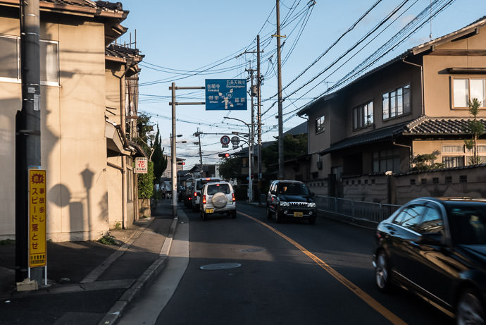
Back in Kyoto City 4:51pm - taken while cycling at 17 kph (11 mph) -- Kyoto, Japan -- Copyright 2016 Jeffrey Friedl, http://regex.info/blog/ -- This photo is licensed to the public under the Creative Commons Attribution-NonCommercial 4.0 International License http://creativecommons.org/licenses/by-nc/4.0/ (non-commercial use is freely allowed if proper attribution is given, including a link back to this page on http://regex.info/ when used online)
Panasonic LX100 at an effective 24mm — 1/125 sec, f/8, ISO 640 — map & image datanearby photos
Back in Kyoto City
4:51pm - taken while cycling at 17 kph (11 mph)
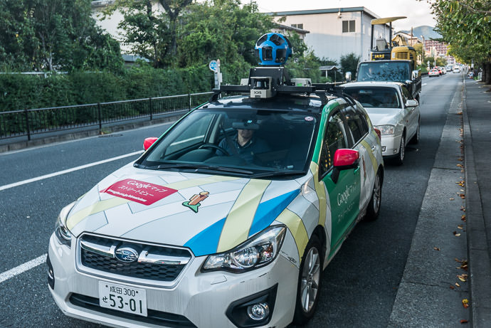
My First Google Car Sighting unlikely, but maybe I'll show up here some day -- Kyoto, Japan -- Copyright 2016 Jeffrey Friedl, http://regex.info/blog/ -- This photo is licensed to the public under the Creative Commons Attribution-NonCommercial 4.0 International License http://creativecommons.org/licenses/by-nc/4.0/ (non-commercial use is freely allowed if proper attribution is given, including a link back to this page on http://regex.info/ when used online)
Panasonic LX100 at an effective 35mm — 1/125 sec, f/2.3, ISO 200 — map & image datanearby photos
My First Google Car Sighting
unlikely, but maybe I'll show up here some day
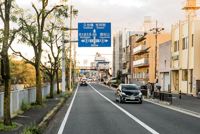
The End is Near National Route 162 dead-ends at the next intersection 5:02pm - taken while cycling at 32 kph (20 mph) -- Kyoto, Japan -- Copyright 2016 Jeffrey Friedl, http://regex.info/blog/ -- This photo is licensed to the public under the Creative Commons Attribution-NonCommercial 4.0 International License http://creativecommons.org/licenses/by-nc/4.0/ (non-commercial use is freely allowed if proper attribution is given, including a link back to this page on http://regex.info/ when used online)
Panasonic LX100 at an effective 35mm — 1/125 sec, f/2.5, ISO 200 — map & image datanearby photos
The End is Near
National Route 162 dead-ends at the next intersection
5:02pm - taken while cycling at 32 kph (20 mph)

With all the stops, National Route 162 took about 5 hours 45 minutes, so with stops I averaged about 21 kph. (For reference, on this ride I averaged almost 32kph for 180km — 19.7mph for 112 mi — though that route was flatter.)
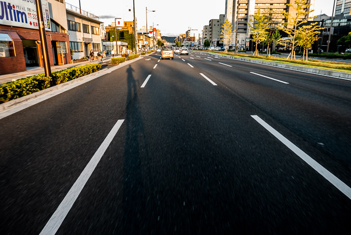
Heading Home 5:10pm - taken while cycling at 29 kph (18 mph) -- Kyoto, Japan -- Copyright 2016 Jeffrey Friedl, http://regex.info/blog/ -- This photo is licensed to the public under the Creative Commons Attribution-NonCommercial 4.0 International License http://creativecommons.org/licenses/by-nc/4.0/ (non-commercial use is freely allowed if proper attribution is given, including a link back to this page on http://regex.info/ when used online)
Panasonic LX100 at an effective 24mm — 1/125 sec, f/2.2, ISO 200 — map & image datanearby photos
Heading Home
5:10pm - taken while cycling at 29 kph (18 mph)

I still felt great, so wanted to use the opportunity of having just ridden 200+km to pile on a few more miles, so I headed up to Shogunzuka, where I used to go up often for sunset photos...
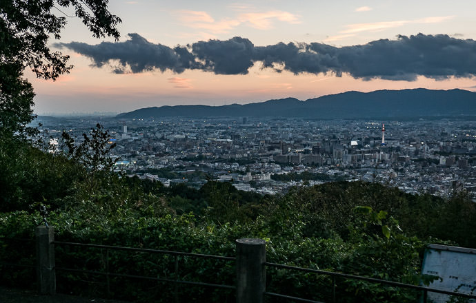
Boring View Today Shogunzuka Overlook (将軍塚) -- Shogunzuka Overlook (将軍塚) -- Kyoto, Japan -- Copyright 2016 Jeffrey Friedl, http://regex.info/blog/ -- This photo is licensed to the public under the Creative Commons Attribution-NonCommercial 4.0 International License http://creativecommons.org/licenses/by-nc/4.0/ (non-commercial use is freely allowed if proper attribution is given, including a link back to this page on http://regex.info/ when used online)
Panasonic LX100 at an effective 46mm — 1/100 sec, f/2.6, ISO 200 — map & image datanearby photos
Boring View Today
Shogunzuka Overlook (将軍塚)

Still wanting to add a few more miles, I headed to a sort-of-far Liquor Mountain store to fetch some treat-for-a-job-well-done Sangria Peñasol, which I discovered some years ago at a wine-tasting event.
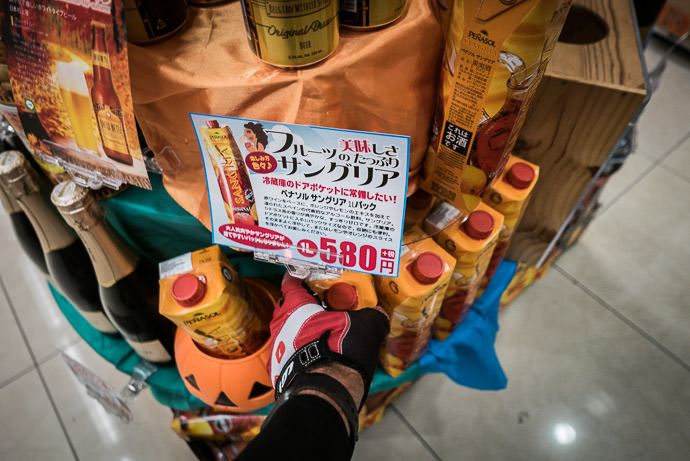
Yum in a Carton fits nicely in one of the jersey-back pockets -- Liquor Mountain -- Kyoto, Japan -- Copyright 2016 Jeffrey Friedl, http://regex.info/blog/ -- This photo is licensed to the public under the Creative Commons Attribution-NonCommercial 4.0 International License http://creativecommons.org/licenses/by-nc/4.0/ (non-commercial use is freely allowed if proper attribution is given, including a link back to this page on http://regex.info/ when used online)
Panasonic LX100 at an effective 24mm — 1/100 sec, f/1.7, ISO 200 — map & image datanearby photos
Yum in a Carton
fits nicely in one of the jersey-back pockets

Here's the Relive.cc video....

The first thing I did when I got home was to charge the Di2 battery.


All 5 comments so far, oldest first...

Interesting report about running out of battery on the DI2. I went and read your post from back when you bought this bike, and I wondering after all this time, do you find the DI2 version much better than the equivalent mechanical version? By better I mean either more comfortable, or more precise, etc.?

To me the biggest change was when moving from lower end to higher end mechanical (XT on MTB, Ultegra on road bike), and I wonder if DI2 would bring anything more. Well, of course, besides statistics of gear use via Garmin 🙂

I’ve never the non-Di2 version, so I can’t compare, but it’s a heck of a lot nicer than the mechanical shifters on my low-end Trek cross bike. —Jeffrey

— comment by Iustin Pop on October 10th, 2016 at 12:34am JST (7 years, 7 months ago) comment permalink

Wow. That island in picture one looks very much like Ailsa Craig in bonnie Scotland.
http://www.rspb.org.uk/Images/1010468_tcm9-246993.jpg?width=1184&crop=(0,220,2630,1320)

Uncannily alike.

— comment by max on October 10th, 2016 at 2:52am JST (7 years, 7 months ago) comment permalink

Wow, great looking ride even though it was on main roads. Sometimes it is more relaxing and enjoyable to just follow one or two routes and not have to worry about complex navigation.

— comment by Rick H. on October 10th, 2016 at 3:05am JST (7 years, 7 months ago) comment permalink

When I first read in the title..”for the sake of it”, I wondered is this going to be like a beer run?
Impressive ride, impressive post. You didn’t get your athletic abilities from my side of the family.

— comment by Grandma Friedl, Ohio, USA on October 10th, 2016 at 12:36pm JST (7 years, 7 months ago) comment permalink

Hi, I discovered you blog back when I first got into photography. I stumbled across you post of the nikon 70-200 2.8 vr1 lens review. I decided to save your blog so I can go back later to read up on your review. So recently was clearing my bookmarks of site that I don’t visit anymore and decided to visit your blog to see if you’re still active. What do I find out! You’re still very actively blogging and also cycling as a hobby. I just started road cycling about a year ago. Just wanted to stop by to say “Hi” and BTW I’m from Southern California, USA. Looking forward to your future post.
-Ken

— comment by Ken on October 11th, 2016 at 11:06am JST (7 years, 6 months ago) comment permalink
Leave a comment...


All comments are invisible to others until Jeffrey approves them.

Please mention what part of the world you're writing from, if you don't mind. It's always interesting to see where people are visiting from.

IMPORTANT:I'm mostly retired, so I don't check comments often anymore, sorry.


You can use basic HTML; be sure to close tags properly.

Subscribe without commenting